Palosco geodata
Palosco (Lombardy) is a seat of a third-order administrative division; located in Italy in Europe/Rome (GMT+2) time zone. With population of 5,233 people, there are 1867 cities with bigger population in this country. Compared to other cities in Italy, 76.6% of cities are located further ↓South; 69.5% of cities are located further →East and 60.8% of cities have higher elevation than Palosco. Note1


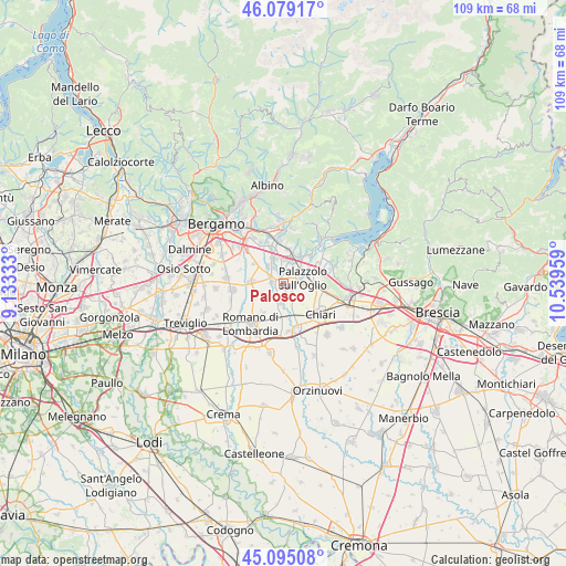
Palosco GPS coordinates[2]
45° 35' 21.408" North, 9° 50' 11.256" East
| Map corner | latitude | longitude |
|---|---|---|
| Upper-left | 46.07917°, | 9.13333° |
| Center: | 45.58928°, | 9.83646° |
| Lower-right: | 45.09508°, | 10.53959° |
| Map W x H: | 109.4×109.4 km | = 68×68mi |
| max Lat: | 47.04031° ⇑23.4% North |
| Palosco: | 45.58928° |
| min Lat: | ⇓76.6% South 35.50142° |
| min Long | Palosco | max Long |
| 6.69888° | 9.83646° | 18.48682° |
| W 30.5%⇐ | ⇒69.5% E |
Elevation
Elevation of Palosco is 157 m = 515 ft, and this is 149.7 m = 491 ft below average elevation for this country.
| Max E: |
2085 m = 6841 ft | 60.8% |
| Avg. | 306.7 m = 1006 ft | |
| Palosco | 157 m = 515 ft | |
Min E: |
-4 m = -13 ft | 39.2% |
See also: Italy elevation on elevation.city.
Geographical zone
Palosco is located in North temperate zone (between Tropic of Cancer and the Arctic Circle). Distance of this North polar circle is 2332.1 km =1449.1 mi to North.| Distance of | km | miles | from Palosco |
|---|---|---|---|
| North Pole | 4938 | 3068.3 | to North |
| Arctic Circle | 2332.1 | 1449.1 | to North |
| Tropic Cancer | 2463.1 | 1530.5 | to South |
| Equator | 5069.1 | 3149.8 | to South |


Nearby cities:
15 places around Palosco: (largest is in red/bold)
• Bolgare
5.1 km =3.2 mi,  340°
340°
• Calcinate
4.5 km =2.8 mi,  318°
318°
• Castelli Calepio
4.6 km =2.9 mi,  55°
55°
• Cavernago
6.8 km =4.2 mi,  305°
305°
• Chiuduno
6.9 km =4.3 mi,  8°
8°
• Cividate al Piano
3.9 km =2.4 mi,  187°
187°
• Cortenuova
6.8 km =4.2 mi,  214°
214°
• Cortenuova di Sopra
6.7 km =4.2 mi,  220°
220°
• Ghisalba
6.2 km =3.9 mi,  274°
274°
• Grumello del Monte
5.9 km =3.7 mi,  30°
30°
• Martinengo
5.7 km =3.5 mi,  250°
250°
• Mornico al Serio
2.1 km =1.3 mi,  276°
276°
• Palazzolo sull'Oglio
4 km =2.5 mi,  78°
78°
• Pontoglio
2.6 km =1.6 mi,  149°
149°
• Telgate
4.4 km =2.7 mi, 12°
Sources, notices
• [Note1] Compared only with cities in Italy existing in our database
• [Src1] Map data: © OpenStreetMap contributors (CC-BY-SA)
• [Src2] Other city data from geonames.org with taken over terms of usage.
• [Src3] Geographical zone / Annual Mean Temperature by Robert A. Rohde @ Wikipedia
