Nocelleto geodata
Nocelleto (Campania) is a populated place; located in Italy in Europe/Rome (GMT+2) time zone. With population of 2,374 people, there are 3668 cities with bigger population in this country. Compared to other cities in Italy, 77.1% of cities are located further ↑North; 78.3% of cities are located further ←West and 81.2% of cities have higher elevation than Nocelleto. Note1


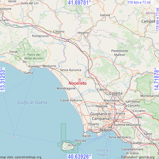
Nocelleto GPS coordinates[2]
41° 10' 14.412" North, 14° 0' 56.34" East
| Map corner | latitude | longitude |
|---|---|---|
| Upper-left | 41.69781°, | 13.31253° |
| Center: | 41.17067°, | 14.01565° |
| Lower-right: | 40.63926°, | 14.71878° |
| Map W x H: | 117.7×117.7 km | = 73.1×73.1mi |
| max Lat: | 47.04031° ⇑77.1% North |
| Nocelleto: | 41.17067° |
| min Lat: | ⇓22.9% South 35.50142° |
| min Long | Nocelleto | max Long |
| 6.69888° | 14.01565° | 18.48682° |
| W 78.3%⇐ | ⇒21.7% E |
Elevation
Elevation of Nocelleto is 45 m = 148 ft, and this is 261.7 m = 859 ft below average elevation for this country.
| Max E: |
2085 m = 6841 ft | 81.2% |
| Avg. | 306.7 m = 1006 ft | |
| Nocelleto | 45 m = 148 ft | |
Min E: |
-4 m = -13 ft | 18.8% |
See also: Italy elevation on elevation.city.
Geographical zone
Nocelleto is located in North temperate zone (between Tropic of Cancer and the Arctic Circle). Distance of this Northern Tropic circle is 1971.8 km =1225.2 mi to South.| Distance of | km | miles | from Nocelleto |
|---|---|---|---|
| North Pole | 5429.3 | 3373.6 | to North |
| Arctic Circle | 2823.4 | 1754.4 | to North |
| Tropic Cancer | 1971.8 | 1225.2 | to South |
| Equator | 4577.7 | 2844.5 | to South |


Nearby cities:
15 places around Nocelleto: (largest is in red/bold)
• Avezzano-Sorbello
8.6 km =5.3 mi,  306°
306°
• Carano
9.7 km =6 mi,  293°
293°
• Carinola
3.4 km =2.1 mi,  304°
304°
• Casale
5.6 km =3.5 mi,  348°
348°
• Casanova
5 km =3.1 mi, 299°
• Cascano
7.9 km =4.9 mi,  330°
330°
• Casi
10 km =6.2 mi,  10°
10°
• Falciano del Massico
5.7 km =3.5 mi,  261°
261°
• Francolise
3.8 km =2.4 mi,  65°
65°
• San Marco
5.9 km =3.7 mi,  3°
3°
• Sant'Agata
9.1 km =5.7 mi, 313°
• Sant'Andrea-Pizzone-Ciamprisco
2.7 km =1.7 mi,  147°
147°
• Scalo Ferroviario
8.5 km =5.3 mi,  35°
35°
• Sparanise
7 km =4.3 mi, 74°
• Teano
9.9 km =6.2 mi,  25°
25°
Sources, notices
• [Note1] Compared only with cities in Italy existing in our database
• [Src1] Map data: © OpenStreetMap contributors (CC-BY-SA)
• [Src2] Other city data from geonames.org with taken over terms of usage.
• [Src3] Geographical zone / Annual Mean Temperature by Robert A. Rohde @ Wikipedia
