Sant'Agata geodata
Sant'Agata (Campania) is a populated place; located in Italy in Europe/Rome (GMT+2) time zone. With population of 748 people, there are 7967 cities with bigger population in this country. Compared to other cities in Italy, 76.7% of cities are located further ↑North; 77.8% of cities are located further ←West and 61.3% of cities have higher elevation than Sant'Agata. Note1


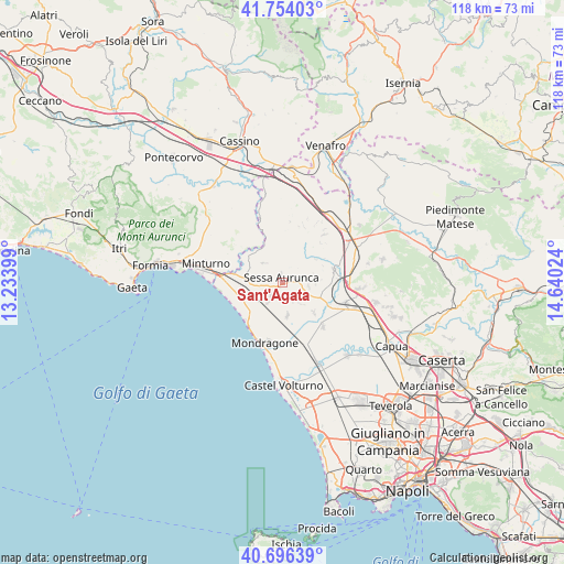
Sant'Agata GPS coordinates[2]
41° 13' 38.46" North, 13° 56' 13.596" East
| Map corner | latitude | longitude |
|---|---|---|
| Upper-left | 41.75403°, | 13.23399° |
| Center: | 41.22735°, | 13.93711° |
| Lower-right: | 40.69639°, | 14.64024° |
| Map W x H: | 117.6×117.6 km | = 73.1×73.1mi |
| max Lat: | 47.04031° ⇑76.7% North |
| Sant'Agata: | 41.22735° |
| min Lat: | ⇓23.3% South 35.50142° |
| min Long | Sant'Agata | max Long |
| 6.69888° | 13.93711° | 18.48682° |
| W 77.8%⇐ | ⇒22.2% E |
Elevation
Elevation of Sant'Agata is 153 m = 502 ft, and this is 153.7 m = 504 ft below average elevation for this country.
| Max E: |
2085 m = 6841 ft | 61.3% |
| Avg. | 306.7 m = 1006 ft | |
| Sant'Agata | 153 m = 502 ft | |
Min E: |
-4 m = -13 ft | 38.7% |
See also: Italy elevation on elevation.city.
Geographical zone
Sant'Agata is located in North temperate zone (between Tropic of Cancer and the Arctic Circle). Distance of this Northern Tropic circle is 1978.1 km =1229.1 mi to South.| Distance of | km | miles | from Sant'Agata |
|---|---|---|---|
| North Pole | 5423 | 3369.7 | to North |
| Arctic Circle | 2817.1 | 1750.5 | to North |
| Tropic Cancer | 1978.1 | 1229.1 | to South |
| Equator | 4584.1 | 2848.4 | to South |


Nearby cities:
15 places around Sant'Agata: (largest is in red/bold)
• Avezzano-Sorbello
1.2 km =0.7 mi,  194°
194°
• Carano
3.4 km =2.1 mi,  223°
223°
• Carinola
5.8 km =3.6 mi,  139°
139°
• Casale
5.5 km =3.4 mi,  98°
98°
• Casanova
4.5 km =2.8 mi,  150°
150°
• Cascano
2.7 km =1.7 mi,  78°
78°
• Casi
9.1 km =5.7 mi,  67°
67°
• Cellole
7.5 km =4.7 mi,  249°
249°
• Falciano del Massico
7.2 km =4.5 mi,  172°
172°
• Lauro
5.6 km =3.5 mi,  316°
316°
• Piedimonte
5.4 km =3.4 mi, 216°
• Roccamonfina
7.5 km =4.7 mi,  27°
27°
• San Castrese
6.9 km =4.3 mi,  300°
300°
• San Marco
7 km =4.3 mi,  93°
93°
• Sessa Aurunca
1.5 km =0.9 mi,  335°
335°
Sources, notices
• [Note1] Compared only with cities in Italy existing in our database
• [Src1] Map data: © OpenStreetMap contributors (CC-BY-SA)
• [Src2] Other city data from geonames.org with taken over terms of usage.
• [Src3] Geographical zone / Annual Mean Temperature by Robert A. Rohde @ Wikipedia
