Noasca geodata
Noasca (Piedmont) is a seat of a third-order administrative division; located in Italy in Europe/Rome (GMT+2) time zone. With population of 75 people, there are 11523 cities with bigger population in this country. Compared to other cities in Italy, 72% of cities are located further ↓South; 98.9% of cities are located further →East and 97.5% of cities have lower elevation than Noasca. Note1


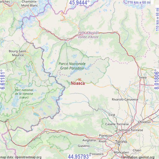
Noasca GPS coordinates[2]
45° 27' 11.952" North, 7° 18' 53.784" East
| Map corner | latitude | longitude |
|---|---|---|
| Upper-left | 45.9444°, | 6.61181° |
| Center: | 45.45332°, | 7.31494° |
| Lower-right: | 44.95793°, | 8.01806° |
| Map W x H: | 109.7×109.7 km | = 68.2×68.2mi |
| max Lat: | 47.04031° ⇑28% North |
| Noasca: | 45.45332° |
| min Lat: | ⇓72% South 35.50142° |
| min Long | Noasca | max Long |
| 6.69888° | 7.31494° | 18.48682° |
| W 1.1%⇐ | ⇒98.9% E |
Elevation
Elevation of Noasca is 1048 m = 3438 ft, and this is 741.3 m = 2432 ft above average elevation for this country.
| Max E: |
2085 m = 6841 ft | 2.5% |
| Noasca | 1048 m 3438 ft | |
| Avg. | 306.7 m = 1006 ft | |
Min E: |
-4 m = -13 ft | 97.5% |
See also: Italy elevation on elevation.city.
Geographical zone
Noasca is located in North temperate zone (between Tropic of Cancer and the Arctic Circle). Distance of this North polar circle is 2347.2 km =1458.5 mi to North.| Distance of | km | miles | from Noasca |
|---|---|---|---|
| North Pole | 4953.1 | 3077.7 | to North |
| Arctic Circle | 2347.2 | 1458.5 | to North |
| Tropic Cancer | 2448 | 1521.1 | to South |
| Equator | 5053.9 | 3140.3 | to South |


Nearby cities:
15 places around Noasca: (largest is in red/bold)
• Ala di Stura
15.4 km =9.6 mi,  183°
183°
• Balme
18.4 km =11.4 mi,  203°
203°
• Cantoira
13.7 km =8.5 mi,  156°
156°
• Ceres
16.6 km =10.3 mi, 159°
• Ceresole Reale
6.7 km =4.2 mi,  249°
249°
• Chialamberto
10.3 km =6.4 mi,  167°
167°
• Cogne
17.5 km =10.9 mi,  11°
11°
• Groscavallo
10.5 km =6.5 mi,  205°
205°
• Locana
11.9 km =7.4 mi,  111°
111°
• Mezzenile
18.7 km =11.6 mi, 160°
• Monastero di Lanzo
19.5 km =12.1 mi,  149°
149°
• Ribordone
14.8 km =9.2 mi,  98°
98°
• Ronco Canavese
18.8 km =11.7 mi,  73°
73°
• Sparone
18.5 km =11.5 mi, 103°
• Valsavarenche
17.4 km =10.8 mi,  332°
332°
Sources, notices
• [Note1] Compared only with cities in Italy existing in our database
• [Src1] Map data: © OpenStreetMap contributors (CC-BY-SA)
• [Src2] Other city data from geonames.org with taken over terms of usage.
• [Src3] Geographical zone / Annual Mean Temperature by Robert A. Rohde @ Wikipedia
