Ceresole Reale geodata
Ceresole Reale (Piedmont) is a seat of a third-order administrative division; located in Italy in Europe/Rome (GMT+2) time zone. With population of 46 people, there are 11610 cities with bigger population in this country. Compared to other cities in Italy, 71.3% of cities are located further ↓South; 99.2% of cities are located further →East and 99.9% of cities have lower elevation than Ceresole Reale. Note1


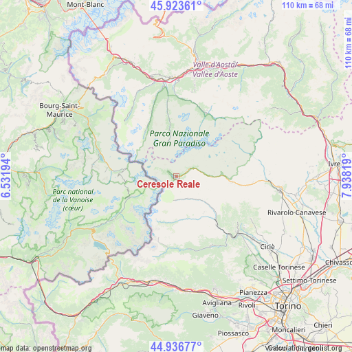
Ceresole Reale GPS coordinates[2]
45° 25' 56.46" North, 7° 14' 6.216" East
| Map corner | latitude | longitude |
|---|---|---|
| Upper-left | 45.92361°, | 6.53194° |
| Center: | 45.43235°, | 7.23506° |
| Lower-right: | 44.93677°, | 7.93819° |
| Map W x H: | 109.7×109.7 km | = 68.2×68.2mi |
| max Lat: | 47.04031° ⇑28.7% North |
| Ceresole Reale: | 45.43235° |
| min Lat: | ⇓71.3% South 35.50142° |
| min Long | Ceresole Reale | max Long |
| 6.69888° | 7.23506° | 18.48682° |
| W 0.8%⇐ | ⇒99.2% E |
Elevation
Elevation of Ceresole Reale is 1615 m = 5299 ft, and this is 1308.3 m = 4292 ft above average elevation for this country.
| Max E: |
2085 m = 6841 ft | 0.099999999999994% |
| Ceresole Reale | 1615 m 5299 ft | |
| Avg. | 306.7 m = 1006 ft | |
Min E: |
-4 m = -13 ft | 99.9% |
See also: Italy elevation on elevation.city.
Geographical zone
Ceresole Reale is located in North temperate zone (between Tropic of Cancer and the Arctic Circle). Distance of this North polar circle is 2349.6 km =1460 mi to North.| Distance of | km | miles | from Ceresole Reale |
|---|---|---|---|
| North Pole | 4955.5 | 3079.2 | to North |
| Arctic Circle | 2349.6 | 1460 | to North |
| Tropic Cancer | 2445.7 | 1519.7 | to South |
| Equator | 5051.6 | 3138.9 | to South |


Nearby cities:
15 places around Ceresole Reale: (largest is in red/bold)
• Ala di Stura
14.1 km =8.8 mi,  157°
157°
• Balme
14.6 km =9.1 mi,  184°
184°
• Cantoira
15.5 km =9.6 mi,  131°
131°
• Ceres
17.9 km =11.1 mi,  137°
137°
• Chialamberto
11.5 km =7.1 mi, 132°
• Cogne
21.7 km =13.5 mi,  26°
26°
• Groscavallo
7.4 km =4.6 mi,  165°
165°
• Locana
17.4 km =10.8 mi,  96°
96°
• Mezzenile
19.8 km =12.3 mi, 140°
• Monastero di Lanzo
21.6 km =13.4 mi, 132°
• Noasca
6.7 km =4.2 mi,  69°
69°
• Pessinetto
21.5 km =13.4 mi, 138°
• Rhemes-Notre-Dame
17.8 km =11.1 mi,  329°
329°
• Ribordone
20.9 km =13 mi,  89°
89°
• Valsavarenche
17.8 km =11.1 mi,  353°
353°
Sources, notices
• [Note1] Compared only with cities in Italy existing in our database
• [Src1] Map data: © OpenStreetMap contributors (CC-BY-SA)
• [Src2] Other city data from geonames.org with taken over terms of usage.
• [Src3] Geographical zone / Annual Mean Temperature by Robert A. Rohde @ Wikipedia
