Cogne geodata
Cogne (Aosta Valley) is a seat of a third-order administrative division; located in Italy in Europe/Rome (GMT+2) time zone. With population of 767 people, there are 7836 cities with bigger population in this country. Compared to other cities in Italy, 77.4% of cities are located further ↓South; 98.6% of cities are located further →East and 99.8% of cities have lower elevation than Cogne. Note1


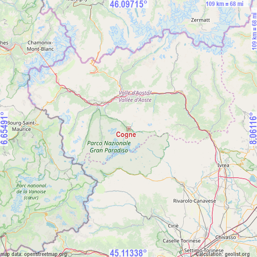
Cogne GPS coordinates[2]
45° 36' 26.712" North, 7° 21' 28.908" East
| Map corner | latitude | longitude |
|---|---|---|
| Upper-left | 46.09715°, | 6.65491° |
| Center: | 45.60742°, | 7.35803° |
| Lower-right: | 45.11338°, | 8.06116° |
| Map W x H: | 109.4×109.4 km | = 68×68mi |
| max Lat: | 47.04031° ⇑22.6% North |
| Cogne: | 45.60742° |
| min Lat: | ⇓77.4% South 35.50142° |
| min Long | Cogne | max Long |
| 6.69888° | 7.35803° | 18.48682° |
| W 1.4%⇐ | ⇒98.6% E |
Elevation
Elevation of Cogne is 1559 m = 5115 ft, and this is 1252.3 m = 4109 ft above average elevation for this country.
| Max E: |
2085 m = 6841 ft | 0.2% |
| Cogne | 1559 m 5115 ft | |
| Avg. | 306.7 m = 1006 ft | |
Min E: |
-4 m = -13 ft | 99.8% |
See also: Italy elevation on elevation.city.
Geographical zone
Cogne is located in North temperate zone (between Tropic of Cancer and the Arctic Circle). Distance of this North polar circle is 2330.1 km =1447.9 mi to North.| Distance of | km | miles | from Cogne |
|---|---|---|---|
| North Pole | 4936 | 3067.1 | to North |
| Arctic Circle | 2330.1 | 1447.9 | to North |
| Tropic Cancer | 2465.2 | 1531.8 | to South |
| Equator | 5071.1 | 3151 | to South |


Nearby cities:
15 places around Cogne: (largest is in red/bold)
• Aosta
14.8 km =9.2 mi,  347°
347°
• Aymavilles
13.6 km =8.5 mi,  320°
320°
• Charvensod
12.8 km =8 mi, 348°
• Grand Brissogne
13.4 km =8.3 mi,  11°
11°
• Gressan
13.5 km =8.4 mi,  338°
338°
• Jovencan
13.7 km =8.5 mi,  330°
330°
• Montan-Angelin-Arensod
14.8 km =9.2 mi, 334°
• Neyran-Etabloz
14.5 km =9 mi,  17°
17°
• Plan Felinaz-Felinaz
13.5 km =8.4 mi, 352°
• Pollein
13.4 km =8.3 mi,  357°
357°
• Pont Suaz-Ampaillant
13.6 km =8.5 mi, 347°
• Saint Maurice
14.6 km =9.1 mi, 326°
• Saint-Pierre
15.4 km =9.6 mi, 318°
• Valsavarenche
11.6 km =7.2 mi,  261°
261°
• Villefranche
15.5 km =9.6 mi, 16°
Sources, notices
• [Note1] Compared only with cities in Italy existing in our database
• [Src1] Map data: © OpenStreetMap contributors (CC-BY-SA)
• [Src2] Other city data from geonames.org with taken over terms of usage.
• [Src3] Geographical zone / Annual Mean Temperature by Robert A. Rohde @ Wikipedia
