Mezzocorona geodata
Mezzocorona (Trentino-Alto Adige) is a seat of a third-order administrative division; located in Italy in Europe/Rome (GMT+2) time zone. With population of 4,975 people, there are 1967 cities with bigger population in this country. Compared to other cities in Italy, 96.1% of cities are located further ↓South; 55.6% of cities are located further →East and 53.6% of cities have higher elevation than Mezzocorona. Note1
Administrative division(s):
- Level 1: Trentino-Alto Adige
- Level 2: Provincia autonoma di Trento
- Level 3: Mezzocorona


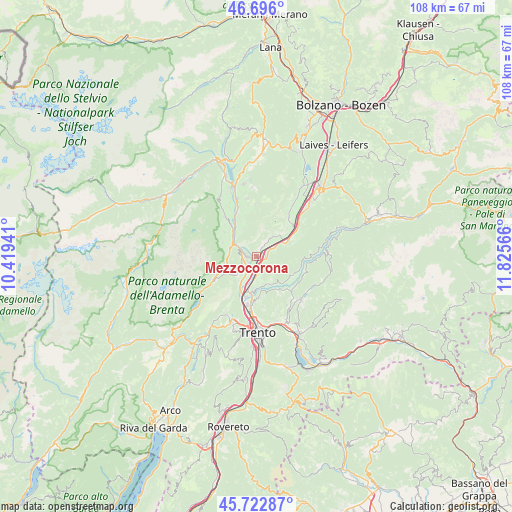
Mezzocorona GPS coordinates[2]
46° 12' 41.724" North, 11° 7' 21.108" East
| Map corner | latitude | longitude |
|---|---|---|
| Upper-left | 46.696°, | 10.41941° |
| Center: | 46.21159°, | 11.12253° |
| Lower-right: | 45.72287°, | 11.82566° |
| Map W x H: | 108.2×108.2 km | = 67.2×67.2mi |
| max Lat: | 47.04031° ⇑3.9% North |
| Mezzocorona: | 46.21159° |
| min Lat: | ⇓96.1% South 35.50142° |
| min Long | Mezzocorona | max Long |
| 6.69888° | 11.12253° | 18.48682° |
| W 44.4%⇐ | ⇒55.6% E |
Elevation
Elevation of Mezzocorona is 212 m = 696 ft, and this is 94.7 m = 311 ft below average elevation for this country.
| Max E: |
2085 m = 6841 ft | 53.6% |
| Avg. | 306.7 m = 1006 ft | |
| Mezzocorona | 212 m = 696 ft | |
Min E: |
-4 m = -13 ft | 46.4% |
See also: Italy elevation on elevation.city.
Geographical zone
Mezzocorona is located in North temperate zone (between Tropic of Cancer and the Arctic Circle). Distance of this North polar circle is 2262.9 km =1406.1 mi to North.| Distance of | km | miles | from Mezzocorona |
|---|---|---|---|
| North Pole | 4868.8 | 3025.3 | to North |
| Arctic Circle | 2262.9 | 1406.1 | to North |
| Tropic Cancer | 2532.3 | 1573.5 | to South |
| Equator | 5138.2 | 3192.7 | to South |


Nearby cities:
15 places around Mezzocorona: (largest is in red/bold)
• Cavedago
7.5 km =4.7 mi,  246°
246°
• Faedo
3.7 km =2.3 mi,  125°
125°
• Fai della Paganella
5.5 km =3.4 mi,  227°
227°
• Giovo
6.6 km =4.1 mi,  159°
159°
• Mezzolombardo
2.1 km =1.3 mi,  257°
257°
• Nave San Rocco
5.1 km =3.2 mi,  195°
195°
• Palù
6.1 km =3.8 mi,  165°
165°
• Pressano
6.7 km =4.2 mi,  190°
190°
• Roverè della Luna
5.7 km =3.5 mi,  41°
41°
• Salorno
7.6 km =4.7 mi,  64°
64°
• San Michele All'Adige
2.5 km =1.6 mi, 163°
• Spormaggiore
5.8 km =3.6 mi,  277°
277°
• Verla
6.4 km =4 mi, 158°
• Vigo di Ton
6.5 km =4 mi,  336°
336°
• Zambana
7 km =4.3 mi, 196°
Sources, notices
• [Note1] Compared only with cities in Italy existing in our database
• [Src1] Map data: © OpenStreetMap contributors (CC-BY-SA)
• [Src2] Other city data from geonames.org with taken over terms of usage.
• [Src3] Geographical zone / Annual Mean Temperature by Robert A. Rohde @ Wikipedia
