Spormaggiore geodata
Spormaggiore (Trentino-Alto Adige) is a seat of a third-order administrative division; located in Italy in Europe/Rome (GMT+2) time zone. With population of 1,174 people, there are 6043 cities with bigger population in this country. Compared to other cities in Italy, 96.2% of cities are located further ↓South; 56.6% of cities are located further →East and 83.1% of cities have lower elevation than Spormaggiore. Note1
Administrative division(s):
- Level 1: Trentino-Alto Adige
- Level 2: Provincia autonoma di Trento
- Level 3: Spormaggiore


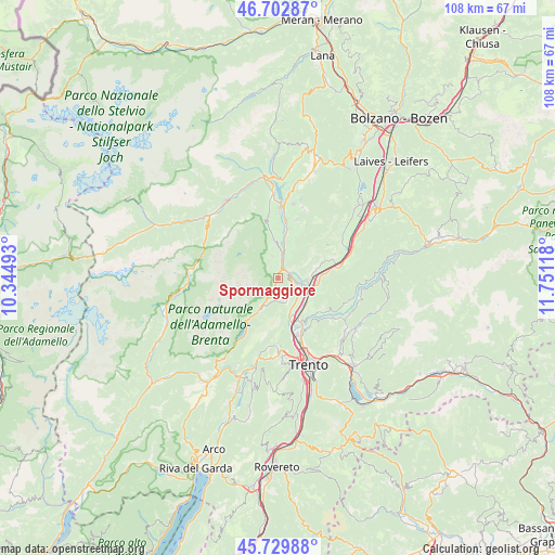
Spormaggiore GPS coordinates[2]
46° 13' 6.708" North, 11° 2' 52.98" East
| Map corner | latitude | longitude |
|---|---|---|
| Upper-left | 46.70287°, | 10.34493° |
| Center: | 46.21853°, | 11.04805° |
| Lower-right: | 45.72988°, | 11.75118° |
| Map W x H: | 108.2×108.2 km | = 67.2×67.2mi |
| max Lat: | 47.04031° ⇑3.8% North |
| Spormaggiore: | 46.21853° |
| min Lat: | ⇓96.2% South 35.50142° |
| min Long | Spormaggiore | max Long |
| 6.69888° | 11.04805° | 18.48682° |
| W 43.4%⇐ | ⇒56.6% E |
Elevation
Elevation of Spormaggiore is 573 m = 1880 ft, and this is 266.3 m = 874 ft above average elevation for this country.
| Max E: |
2085 m = 6841 ft | 16.9% |
| Spormaggiore | 573 m 1880 ft | |
| Avg. | 306.7 m = 1006 ft | |
Min E: |
-4 m = -13 ft | 83.1% |
See also: Italy elevation on elevation.city.
Geographical zone
Spormaggiore is located in North temperate zone (between Tropic of Cancer and the Arctic Circle). Distance of this North polar circle is 2262.2 km =1405.7 mi to North.| Distance of | km | miles | from Spormaggiore |
|---|---|---|---|
| North Pole | 4868 | 3024.8 | to North |
| Arctic Circle | 2262.2 | 1405.7 | to North |
| Tropic Cancer | 2533.1 | 1574 | to South |
| Equator | 5139 | 3193.2 | to South |


Nearby cities:
15 places around Spormaggiore: (largest is in red/bold)
• Andalo
6.7 km =4.2 mi,  210°
210°
• Campodenno
4.5 km =2.8 mi,  345°
345°
• Cavedago
3.9 km =2.4 mi,  197°
197°
• Cunevo
7.6 km =4.7 mi, 352°
• Denno
6.2 km =3.9 mi,  0°
0°
• Fai della Paganella
4.8 km =3 mi,  159°
159°
• Flavon
9 km =5.6 mi, 351°
• Mezzocorona
5.8 km =3.6 mi,  97°
97°
• Mezzolombardo
3.9 km =2.4 mi,  107°
107°
• Nave San Rocco
7.2 km =4.5 mi,  142°
142°
• Pressano
8.6 km =5.3 mi,  148°
148°
• San Michele All'Adige
7.2 km =4.5 mi,  116°
116°
• Sporminore
2.5 km =1.6 mi,  324°
324°
• Vigo di Ton
6 km =3.7 mi,  30°
30°
• Zambana
8.3 km =5.2 mi, 153°
Sources, notices
• [Note1] Compared only with cities in Italy existing in our database
• [Src1] Map data: © OpenStreetMap contributors (CC-BY-SA)
• [Src2] Other city data from geonames.org with taken over terms of usage.
• [Src3] Geographical zone / Annual Mean Temperature by Robert A. Rohde @ Wikipedia
