Lombardore geodata
Lombardore (Piedmont) is a seat of a third-order administrative division; located in Italy in Europe/Rome (GMT+2) time zone. With population of 1,308 people, there are 5610 cities with bigger population in this country. Compared to other cities in Italy, 65.8% of cities are located further ↓South; 96.1% of cities are located further →East and 55.3% of cities have lower elevation than Lombardore. Note1


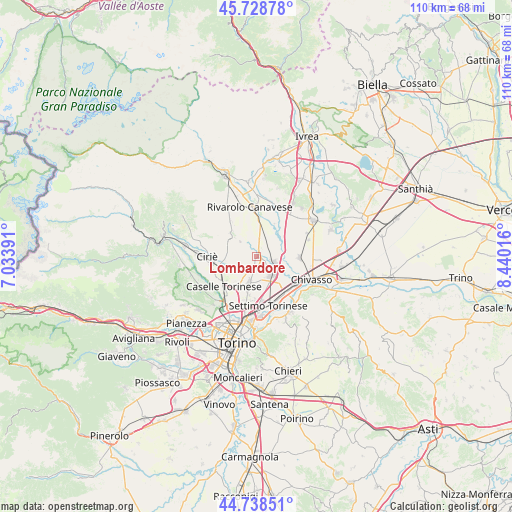
Lombardore GPS coordinates[2]
45° 14' 8.88" North, 7° 44' 13.308" East
| Map corner | latitude | longitude |
|---|---|---|
| Upper-left | 45.72878°, | 7.03391° |
| Center: | 45.2358°, | 7.73703° |
| Lower-right: | 44.73851°, | 8.44016° |
| Map W x H: | 110.1×110.1 km | = 68.4×68.4mi |
| max Lat: | 47.04031° ⇑34.2% North |
| Lombardore: | 45.2358° |
| min Lat: | ⇓65.8% South 35.50142° |
| min Long | Lombardore | max Long |
| 6.69888° | 7.73703° | 18.48682° |
| W 3.9%⇐ | ⇒96.1% E |
Elevation
Elevation of Lombardore is 267 m = 876 ft, and this is 39.7 m = 130 ft below average elevation for this country.
| Max E: |
2085 m = 6841 ft | 44.7% |
| Avg. | 306.7 m = 1006 ft | |
| Lombardore | 267 m = 876 ft | |
Min E: |
-4 m = -13 ft | 55.3% |
See also: Italy elevation on elevation.city.
Geographical zone
Lombardore is located in North temperate zone (between Tropic of Cancer and the Arctic Circle). Distance of this North polar circle is 2371.4 km =1473.5 mi to North.| Distance of | km | miles | from Lombardore |
|---|---|---|---|
| North Pole | 4977.3 | 3092.7 | to North |
| Arctic Circle | 2371.4 | 1473.5 | to North |
| Tropic Cancer | 2423.8 | 1506.1 | to South |
| Equator | 5029.7 | 3125.3 | to South |


Nearby cities:
15 places around Lombardore: (largest is in red/bold)
• Bosconero
4.1 km =2.5 mi,  33°
33°
• Caselle Torinese
10 km =6.2 mi,  227°
227°
• Feletto
7.5 km =4.7 mi,  4°
4°
• Foglizzo
7.8 km =4.8 mi,  57°
57°
• Front
7.5 km =4.7 mi,  310°
310°
• Leini
6.2 km =3.9 mi,  196°
196°
• Lusigliè
9.4 km =5.8 mi,  13°
13°
• Malanghero
7.1 km =4.4 mi,  236°
236°
• Mappano
10 km =6.2 mi,  193°
193°
• Montanaro
9.2 km =5.7 mi,  92°
92°
• Rivarossa
2.1 km =1.3 mi,  318°
318°
• San Benigno Canavese
3.9 km =2.4 mi,  106°
106°
• San Francesco al Campo
6.5 km =4 mi,  261°
261°
• San Maurizio
8.6 km =5.3 mi, 255°
• Volpiano
5 km =3.1 mi,  143°
143°
Sources, notices
• [Note1] Compared only with cities in Italy existing in our database
• [Src1] Map data: © OpenStreetMap contributors (CC-BY-SA)
• [Src2] Other city data from geonames.org with taken over terms of usage.
• [Src3] Geographical zone / Annual Mean Temperature by Robert A. Rohde @ Wikipedia
