Volpiano geodata
Volpiano (Piedmont) is a seat of a third-order administrative division; located in Italy in Europe/Rome (GMT+2) time zone. With population of 14,371 people, there are 632 cities with bigger population in this country. Compared to other cities in Italy, 65% of cities are located further ↓South; 95.8% of cities are located further →East and 52.2% of cities have higher elevation than Volpiano. Note1


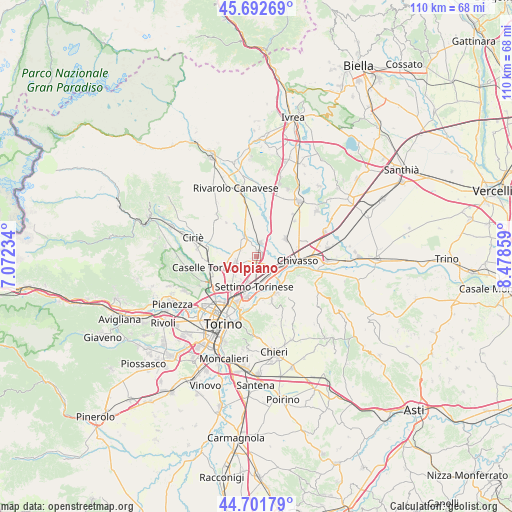
Volpiano GPS coordinates[2]
45° 11' 57.84" North, 7° 46' 31.656" East
| Map corner | latitude | longitude |
|---|---|---|
| Upper-left | 45.69269°, | 7.07234° |
| Center: | 45.1994°, | 7.77546° |
| Lower-right: | 44.70179°, | 8.47859° |
| Map W x H: | 110.2×110.2 km | = 68.5×68.5mi |
| max Lat: | 47.04031° ⇑35% North |
| Volpiano: | 45.1994° |
| min Lat: | ⇓65% South 35.50142° |
| min Long | Volpiano | max Long |
| 6.69888° | 7.77546° | 18.48682° |
| W 4.2%⇐ | ⇒95.8% E |
Elevation
Elevation of Volpiano is 221 m = 725 ft, and this is 85.7 m = 281 ft below average elevation for this country.
| Max E: |
2085 m = 6841 ft | 52.2% |
| Avg. | 306.7 m = 1006 ft | |
| Volpiano | 221 m = 725 ft | |
Min E: |
-4 m = -13 ft | 47.8% |
See also: Italy elevation on elevation.city.
Geographical zone
Volpiano is located in North temperate zone (between Tropic of Cancer and the Arctic Circle). Distance of this North polar circle is 2375.5 km =1476.1 mi to North.| Distance of | km | miles | from Volpiano |
|---|---|---|---|
| North Pole | 4981.4 | 3095.3 | to North |
| Arctic Circle | 2375.5 | 1476.1 | to North |
| Tropic Cancer | 2419.8 | 1503.6 | to South |
| Equator | 5025.7 | 3122.8 | to South |


Nearby cities:
15 places around Volpiano: (largest is in red/bold)
• Bosconero
7.5 km =4.7 mi,  354°
354°
• Brandizzo
5.3 km =3.3 mi,  117°
117°
• Foglizzo
9 km =5.6 mi,  23°
23°
• Gassino Torinese
8.9 km =5.5 mi,  151°
151°
• Leini
5.1 km =3.2 mi,  248°
248°
• Lombardore
5 km =3.1 mi,  323°
323°
• Malanghero
8.9 km =5.5 mi,  270°
270°
• Mappano
7.8 km =4.8 mi,  223°
223°
• Montanaro
7.2 km =4.5 mi,  59°
59°
• Olimpia
8.9 km =5.5 mi,  203°
203°
• Piana San Raffaele
7.8 km =4.8 mi,  131°
131°
• Rivarossa
7.1 km =4.4 mi, 321°
• San Benigno Canavese
3.1 km =1.9 mi,  13°
13°
• San Raffaele Cimena
8.2 km =5.1 mi,  135°
135°
• Settimo Torinese
6.7 km =4.2 mi,  183°
183°
Sources, notices
• [Note1] Compared only with cities in Italy existing in our database
• [Src1] Map data: © OpenStreetMap contributors (CC-BY-SA)
• [Src2] Other city data from geonames.org with taken over terms of usage.
• [Src3] Geographical zone / Annual Mean Temperature by Robert A. Rohde @ Wikipedia
