Levaldigi geodata
Levaldigi (Piedmont) is a populated place; located in Italy in Europe/Rome (GMT+2) time zone. With population of 553 people, there are 9420 cities with bigger population in this country. Compared to other cities in Italy, 51.8% of cities are located further ↓South; 96.9% of cities are located further →East and 67.9% of cities have lower elevation than Levaldigi. Note1


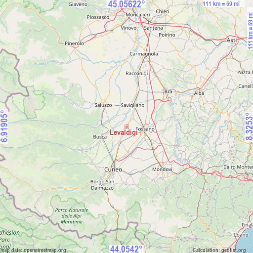
Levaldigi GPS coordinates[2]
44° 33' 26.532" North, 7° 37' 19.848" East
| Map corner | latitude | longitude |
|---|---|---|
| Upper-left | 45.05622°, | 6.91905° |
| Center: | 44.55737°, | 7.62218° |
| Lower-right: | 44.0542°, | 8.3253° |
| Map W x H: | 111.4×111.4 km | = 69.2×69.2mi |
| max Lat: | 47.04031° ⇑48.2% North |
| Levaldigi: | 44.55737° |
| min Lat: | ⇓51.8% South 35.50142° |
| min Long | Levaldigi | max Long |
| 6.69888° | 7.62218° | 18.48682° |
| W 3.1%⇐ | ⇒96.9% E |
Elevation
Elevation of Levaldigi is 373 m = 1224 ft, and this is 66.3 m = 218 ft above average elevation for this country.
| Max E: |
2085 m = 6841 ft | 32.1% |
| Levaldigi | 373 m 1224 ft | |
| Avg. | 306.7 m = 1006 ft | |
Min E: |
-4 m = -13 ft | 67.9% |
See also: Italy elevation on elevation.city.
Geographical zone
Levaldigi is located in North temperate zone (between Tropic of Cancer and the Arctic Circle). Distance of this Northern Tropic circle is 2348.4 km =1459.2 mi to South.| Distance of | km | miles | from Levaldigi |
|---|---|---|---|
| North Pole | 5052.7 | 3139.6 | to North |
| Arctic Circle | 2446.9 | 1520.4 | to North |
| Tropic Cancer | 2348.4 | 1459.2 | to South |
| Equator | 4954.3 | 3078.5 | to South |


Nearby cities:
15 places around Levaldigi: (largest is in red/bold)
• Centallo
6.8 km =4.2 mi,  203°
203°
• Costiglione Saluzzo
10.9 km =6.8 mi,  274°
274°
• Fossano
7.7 km =4.8 mi,  95°
95°
• Genola
4.8 km =3 mi,  39°
39°
• Lagnasco
9.2 km =5.7 mi,  324°
324°
• Montanera
11.1 km =6.9 mi,  161°
161°
• Roata Chiusani
10.9 km =6.8 mi,  192°
192°
• San Biagio
8.5 km =5.3 mi, 186°
• Sant'Albano Stura
9.7 km =6 mi,  124°
124°
• Savigliano
10.5 km =6.5 mi,  15°
15°
• Tarantasca
9.4 km =5.8 mi,  220°
220°
• Trinità
12 km =7.5 mi, 117°
• Verzuolo
11.8 km =7.3 mi,  289°
289°
• Villafalletto
6.6 km =4.1 mi,  259°
259°
• Vottignasco
3.5 km =2.2 mi,  282°
282°
Sources, notices
• [Note1] Compared only with cities in Italy existing in our database
• [Src1] Map data: © OpenStreetMap contributors (CC-BY-SA)
• [Src2] Other city data from geonames.org with taken over terms of usage.
• [Src3] Geographical zone / Annual Mean Temperature by Robert A. Rohde @ Wikipedia
