Lesignana geodata
Lesignana (Emilia-Romagna) is a populated place; located in Italy in Europe/Rome (GMT+2) time zone. With population of 836 people, there are 7467 cities with bigger population in this country. Compared to other cities in Italy, 53.9% of cities are located further ↓South; 58.6% of cities are located further →East and 83.1% of cities have higher elevation than Lesignana. Note1


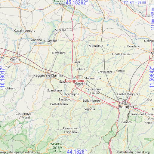
Lesignana GPS coordinates[2]
44° 41' 5.532" North, 10° 53' 35.844" East
| Map corner | latitude | longitude |
|---|---|---|
| Upper-left | 45.18262°, | 10.19017° |
| Center: | 44.68487°, | 10.89329° |
| Lower-right: | 44.1828°, | 11.59642° |
| Map W x H: | 111.2×111.2 km | = 69.1×69.1mi |
| max Lat: | 47.04031° ⇑46.1% North |
| Lesignana: | 44.68487° |
| min Lat: | ⇓53.9% South 35.50142° |
| min Long | Lesignana | max Long |
| 6.69888° | 10.89329° | 18.48682° |
| W 41.4%⇐ | ⇒58.6% E |
Elevation
Elevation of Lesignana is 37 m = 121 ft, and this is 269.7 m = 885 ft below average elevation for this country.
| Max E: |
2085 m = 6841 ft | 83.1% |
| Avg. | 306.7 m = 1006 ft | |
| Lesignana | 37 m = 121 ft | |
Min E: |
-4 m = -13 ft | 16.9% |
See also: Italy elevation on elevation.city.
Geographical zone
Lesignana is located in North temperate zone (between Tropic of Cancer and the Arctic Circle). Distance of this Northern Tropic circle is 2362.6 km =1468.1 mi to South.| Distance of | km | miles | from Lesignana |
|---|---|---|---|
| North Pole | 5038.6 | 3130.8 | to North |
| Arctic Circle | 2432.7 | 1511.6 | to North |
| Tropic Cancer | 2362.6 | 1468.1 | to South |
| Equator | 4968.5 | 3087.3 | to South |


Nearby cities:
15 places around Lesignana: (largest is in red/bold)
• Albareto
5.9 km =3.7 mi,  84°
84°
• Baggiovara
9.3 km =5.8 mi,  195°
195°
• Bastiglia
9.5 km =5.9 mi,  60°
60°
• Campogalliano
3.7 km =2.3 mi,  276°
276°
• Fontana
7.2 km =4.5 mi,  263°
263°
• Gargallo
6.9 km =4.3 mi,  338°
338°
• Limidi
9.1 km =5.7 mi,  13°
13°
• Modena
4.8 km =3 mi,  148°
148°
• Rubiera
9.7 km =6 mi,  247°
247°
• San Faustino
8.9 km =5.5 mi,  266°
266°
• San Martino in Rio
10.1 km =6.3 mi,  302°
302°
• Santa Croce Scuole
9.3 km =5.8 mi, 338°
• Soliera
5.9 km =3.7 mi,  22°
22°
• Sozzigalli
9.6 km =6 mi,  41°
41°
• Villanova
2 km =1.2 mi, 76°
Sources, notices
• [Note1] Compared only with cities in Italy existing in our database
• [Src1] Map data: © OpenStreetMap contributors (CC-BY-SA)
• [Src2] Other city data from geonames.org with taken over terms of usage.
• [Src3] Geographical zone / Annual Mean Temperature by Robert A. Rohde @ Wikipedia
