Modena geodata
Modena (Emilia-Romagna) is a seat of a second-order administrative division; located in Italy in Europe/Rome (GMT+2) time zone. With population of 158,886 people, there are 18 cities with bigger population in this country. Compared to other cities in Italy, 53.3% of cities are located further ↓South; 58.2% of cities are located further →East and 80.9% of cities have higher elevation than Modena. Note1


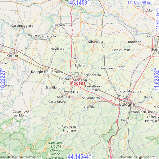
Modena GPS coordinates[2]
44° 38' 52.188" North, 10° 55' 31.404" East
| Map corner | latitude | longitude |
|---|---|---|
| Upper-left | 45.1459°, | 10.22227° |
| Center: | 44.64783°, | 10.92539° |
| Lower-right: | 44.14544°, | 11.62852° |
| Map W x H: | 111.2×111.2 km | = 69.1×69.1mi |
| max Lat: | 47.04031° ⇑46.7% North |
| Modena: | 44.64783° |
| min Lat: | ⇓53.3% South 35.50142° |
| min Long | Modena | max Long |
| 6.69888° | 10.92539° | 18.48682° |
| W 41.8%⇐ | ⇒58.2% E |
Elevation
Elevation of Modena is 46 m = 151 ft, and this is 260.7 m = 855 ft below average elevation for this country.
| Max E: |
2085 m = 6841 ft | 80.9% |
| Avg. | 306.7 m = 1006 ft | |
| Modena | 46 m = 151 ft | |
Min E: |
-4 m = -13 ft | 19.1% |
See also: Modena elevation on elevation.city.
Geographical zone
Modena is located in North temperate zone (between Tropic of Cancer and the Arctic Circle). Distance of this Northern Tropic circle is 2358.5 km =1465.5 mi to South.| Distance of | km | miles | from Modena |
|---|---|---|---|
| North Pole | 5042.7 | 3133.4 | to North |
| Arctic Circle | 2436.8 | 1514.2 | to North |
| Tropic Cancer | 2358.5 | 1465.5 | to South |
| Equator | 4964.4 | 3084.7 | to South |


Nearby cities:
15 places around Modena: (largest is in red/bold)
• Albareto
5.7 km =3.5 mi,  35°
35°
• Baggiovara
6.9 km =4.3 mi,  225°
225°
• Campogalliano
7.7 km =4.8 mi,  306°
306°
• Fontana
10.3 km =6.4 mi,  288°
288°
• Formigine
10.4 km =6.5 mi,  216°
216°
• Gaggio
7.1 km =4.4 mi,  101°
101°
• Lesignana
4.8 km =3 mi,  328°
328°
• Montale
8.9 km =5.5 mi,  189°
189°
• Nonantola
9.5 km =5.9 mi,  69°
69°
• Portile
7.5 km =4.7 mi,  172°
172°
• San Damaso
6.5 km =4 mi,  143°
143°
• San Donnino
7.9 km =4.9 mi,  155°
155°
• Sant'Anna
9.1 km =5.7 mi,  126°
126°
• Soliera
9.6 km =6 mi,  358°
358°
• Villanova
4.6 km =2.9 mi,  352°
352°
Sources, notices
• [Note1] Compared only with cities in Italy existing in our database
• [Src1] Map data: © OpenStreetMap contributors (CC-BY-SA)
• [Src2] Other city data from geonames.org with taken over terms of usage.
• [Src3] Geographical zone / Annual Mean Temperature by Robert A. Rohde @ Wikipedia
