Laives geodata
Laives (Trentino-Alto Adige) is a seat of a third-order administrative division; located in Italy in Europe/Rome (GMT+2) time zone. With population of 10,710 people, there are 887 cities with bigger population in this country. Compared to other cities in Italy, 97.9% of cities are located further ↓South; 52.7% of cities are located further →East and 52.5% of cities have lower elevation than Laives. Note1


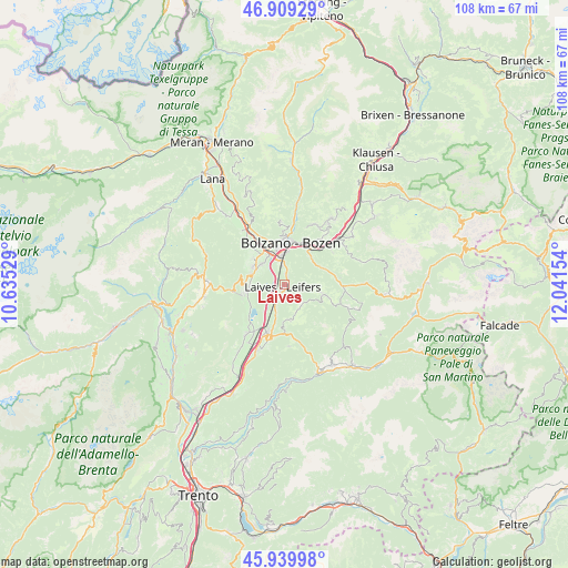
Laives GPS coordinates[2]
46° 25' 36.444" North, 11° 20' 18.276" East
| Map corner | latitude | longitude |
|---|---|---|
| Upper-left | 46.90929°, | 10.63529° |
| Center: | 46.42679°, | 11.33841° |
| Lower-right: | 45.93998°, | 12.04154° |
| Map W x H: | 107.8×107.8 km | = 67×67mi |
| max Lat: | 47.04031° ⇑2.1% North |
| Laives: | 46.42679° |
| min Lat: | ⇓97.9% South 35.50142° |
| min Long | Laives | max Long |
| 6.69888° | 11.33841° | 18.48682° |
| W 47.3%⇐ | ⇒52.7% E |
Elevation
Elevation of Laives is 250 m = 820 ft, and this is 56.7 m = 186 ft below average elevation for this country.
| Max E: |
2085 m = 6841 ft | 47.5% |
| Avg. | 306.7 m = 1006 ft | |
| Laives | 250 m = 820 ft | |
Min E: |
-4 m = -13 ft | 52.5% |
See also: Italy elevation on elevation.city.
Geographical zone
Laives is located in North temperate zone (between Tropic of Cancer and the Arctic Circle). Distance of this North polar circle is 2239 km =1391.2 mi to North.| Distance of | km | miles | from Laives |
|---|---|---|---|
| North Pole | 4844.9 | 3010.5 | to North |
| Arctic Circle | 2239 | 1391.2 | to North |
| Tropic Cancer | 2556.3 | 1588.4 | to South |
| Equator | 5162.2 | 3207.6 | to South |


Nearby cities:
15 places around Laives: (largest is in red/bold)
• Aldino
6.9 km =4.3 mi,  169°
169°
• Bolzano
7.1 km =4.4 mi,  0°
0°
• Bronzolo
2.9 km =1.8 mi,  207°
207°
• Caldaro sulla Strada del Vino
7.2 km =4.5 mi,  257°
257°
• Cardano
8.5 km =5.3 mi,  29°
29°
• Cornaiano
6 km =3.7 mi,  312°
312°
• Cornedo All'Isarco
8.7 km =5.4 mi,  36°
36°
• Nova Ponente
6.8 km =4.2 mi,  102°
102°
• Ora
9.4 km =5.8 mi,  199°
199°
• Pineta
1.6 km =1 mi,  24°
24°
• San Giacomo
3.3 km =2.1 mi,  353°
353°
• San Michele
6.6 km =4.1 mi,  297°
297°
• San Paolo
7.8 km =4.8 mi, 310°
• Settequerce
10.9 km =6.8 mi,  328°
328°
• Vadena
3 km =1.9 mi,  240°
240°
Sources, notices
• [Note1] Compared only with cities in Italy existing in our database
• [Src1] Map data: © OpenStreetMap contributors (CC-BY-SA)
• [Src2] Other city data from geonames.org with taken over terms of usage.
• [Src3] Geographical zone / Annual Mean Temperature by Robert A. Rohde @ Wikipedia
