Grigno geodata
Grigno (Trentino-Alto Adige) is a seat of a third-order administrative division; located in Italy in Europe/Rome (GMT+2) time zone. With population of 764 people, there are 7855 cities with bigger population in this country. Compared to other cities in Italy, 92.3% of cities are located further ↓South; 51% of cities are located further ←West and 54.9% of cities have lower elevation than Grigno. Note1
Administrative division(s):
- Level 1: Trentino-Alto Adige
- Level 2: Provincia autonoma di Trento
- Level 3: Grigno


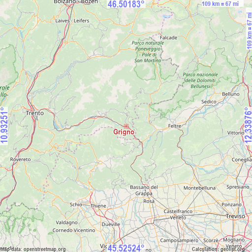
Grigno GPS coordinates[2]
46° 0' 56.484" North, 11° 38' 8.268" East
| Map corner | latitude | longitude |
|---|---|---|
| Upper-left | 46.50183°, | 10.93251° |
| Center: | 46.01569°, | 11.63563° |
| Lower-right: | 45.52524°, | 12.33876° |
| Map W x H: | 108.6×108.6 km | = 67.5×67.5mi |
| max Lat: | 47.04031° ⇑7.7% North |
| Grigno: | 46.01569° |
| min Lat: | ⇓92.3% South 35.50142° |
| min Long | Grigno | max Long |
| 6.69888° | 11.63563° | 18.48682° |
| W 51%⇐ | ⇒49% E |
Elevation
Elevation of Grigno is 265 m = 869 ft, and this is 41.7 m = 137 ft below average elevation for this country.
| Max E: |
2085 m = 6841 ft | 45.1% |
| Avg. | 306.7 m = 1006 ft | |
| Grigno | 265 m = 869 ft | |
Min E: |
-4 m = -13 ft | 54.9% |
See also: Italy elevation on elevation.city.
Geographical zone
Grigno is located in North temperate zone (between Tropic of Cancer and the Arctic Circle). Distance of this North polar circle is 2284.7 km =1419.6 mi to North.| Distance of | km | miles | from Grigno |
|---|---|---|---|
| North Pole | 4890.6 | 3038.9 | to North |
| Arctic Circle | 2284.7 | 1419.6 | to North |
| Tropic Cancer | 2510.5 | 1560 | to South |
| Equator | 5116.5 | 3179.2 | to South |


Nearby cities:
15 places around Grigno: (largest is in red/bold)
• Arsiè
10.2 km =6.3 mi,  111°
111°
• Bieno
9.6 km =6 mi,  320°
320°
• Castello Tesino
5.3 km =3.3 mi,  357°
357°
• Castelnuovo
12.1 km =7.5 mi,  290°
290°
• Cinte Tesino
4.9 km =3 mi,  340°
340°
• Enego
9.8 km =6.1 mi,  146°
146°
• Lamon
9.5 km =5.9 mi,  68°
68°
• Ospedaletto
7 km =4.3 mi,  295°
295°
• Pieve Tesino
6.1 km =3.8 mi, 342°
• Samone
11.4 km =7.1 mi,  310°
310°
• Scurelle
11.4 km =7.1 mi, 298°
• Spera
11.5 km =7.1 mi, 301°
• Strigno
10.4 km =6.5 mi, 303°
• Tezze
3.8 km =2.4 mi,  135°
135°
• Villa-Agnedo
9.3 km =5.8 mi, 297°
Sources, notices
• [Note1] Compared only with cities in Italy existing in our database
• [Src1] Map data: © OpenStreetMap contributors (CC-BY-SA)
• [Src2] Other city data from geonames.org with taken over terms of usage.
• [Src3] Geographical zone / Annual Mean Temperature by Robert A. Rohde @ Wikipedia
