Enego geodata
Enego (Veneto) is a seat of a third-order administrative division; located in Italy in Europe/Rome (GMT+2) time zone. With population of 1,207 people, there are 5936 cities with bigger population in this country. Compared to other cities in Italy, 90.3% of cities are located further ↓South; 51.8% of cities are located further ←West and 91.7% of cities have lower elevation than Enego. Note1


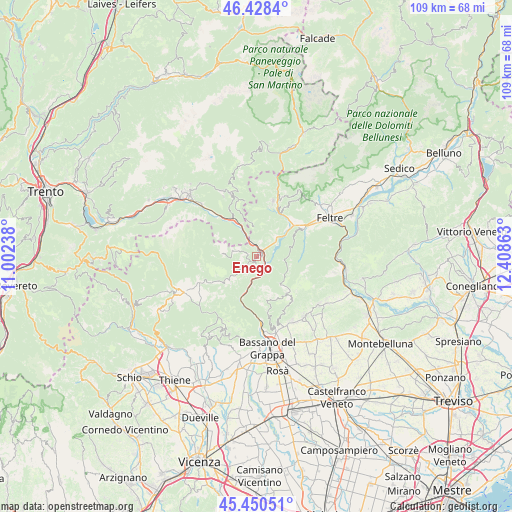
Enego GPS coordinates[2]
45° 56' 29.796" North, 11° 42' 19.8" East
| Map corner | latitude | longitude |
|---|---|---|
| Upper-left | 46.4284°, | 11.00238° |
| Center: | 45.94161°, | 11.7055° |
| Lower-right: | 45.45051°, | 12.40863° |
| Map W x H: | 108.7×108.7 km | = 67.5×67.5mi |
| max Lat: | 47.04031° ⇑9.7% North |
| Enego: | 45.94161° |
| min Lat: | ⇓90.3% South 35.50142° |
| min Long | Enego | max Long |
| 6.69888° | 11.7055° | 18.48682° |
| W 51.8%⇐ | ⇒48.2% E |
Elevation
Elevation of Enego is 761 m = 2497 ft, and this is 454.3 m = 1490 ft above average elevation for this country.
| Max E: |
2085 m = 6841 ft | 8.3% |
| Enego | 761 m 2497 ft | |
| Avg. | 306.7 m = 1006 ft | |
Min E: |
-4 m = -13 ft | 91.7% |
See also: Italy elevation on elevation.city.
Geographical zone
Enego is located in North temperate zone (between Tropic of Cancer and the Arctic Circle). Distance of this North polar circle is 2292.9 km =1424.7 mi to North.| Distance of | km | miles | from Enego |
|---|---|---|---|
| North Pole | 4898.8 | 3044 | to North |
| Arctic Circle | 2292.9 | 1424.7 | to North |
| Tropic Cancer | 2502.3 | 1554.9 | to South |
| Equator | 5108.2 | 3174.1 | to South |


Nearby cities:
15 places around Enego: (largest is in red/bold)
• Arsiè
6.1 km =3.8 mi,  41°
41°
• Arten
12 km =7.5 mi,  52°
52°
• Campolongo sul Brenta
12.7 km =7.9 mi,  181°
181°
• Cismon del Grappa
3 km =1.9 mi,  143°
143°
• Fonzaso
11 km =6.8 mi, 40°
• Foza
7.6 km =4.7 mi,  229°
229°
• Grigno
9.8 km =6.1 mi,  326°
326°
• Lamon
12.2 km =7.6 mi,  16°
16°
• San Nazario
11.4 km =7.1 mi,  186°
186°
• Seren del Grappa
13.1 km =8.1 mi,  62°
62°
• Servo
14.4 km =8.9 mi,  25°
25°
• Solagna
13.6 km =8.5 mi, 175°
• Sovramonte
14.4 km =8.9 mi, 25°
• Tezze
6.2 km =3.9 mi, 333°
• Valstagna
10.5 km =6.5 mi,  196°
196°
Sources, notices
• [Note1] Compared only with cities in Italy existing in our database
• [Src1] Map data: © OpenStreetMap contributors (CC-BY-SA)
• [Src2] Other city data from geonames.org with taken over terms of usage.
• [Src3] Geographical zone / Annual Mean Temperature by Robert A. Rohde @ Wikipedia
