Gambettola geodata
Gambettola (Emilia-Romagna) is a seat of a third-order administrative division; located in Italy in Europe/Rome (GMT+2) time zone. With population of 10,034 people, there are 946 cities with bigger population in this country. Compared to other cities in Italy, 53.5% of cities are located further ↑North; 60.5% of cities are located further ←West and 86.1% of cities have higher elevation than Gambettola. Note1
Administrative division(s):
- Level 1: Emilia-Romagna
- Level 2: Provincia di Forlì-Cesena
- Level 3: Gambettola


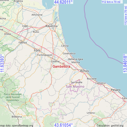
Gambettola GPS coordinates[2]
44° 7' 2.928" North, 12° 20' 13.38" East
| Map corner | latitude | longitude |
|---|---|---|
| Upper-left | 44.62011°, | 11.63393° |
| Center: | 44.11748°, | 12.33705° |
| Lower-right: | 43.61054°, | 13.04018° |
| Map W x H: | 112.3×112.3 km | = 69.8×69.8mi |
| max Lat: | 47.04031° ⇑53.5% North |
| Gambettola: | 44.11748° |
| min Lat: | ⇓46.5% South 35.50142° |
| min Long | Gambettola | max Long |
| 6.69888° | 12.33705° | 18.48682° |
| W 60.5%⇐ | ⇒39.5% E |
Elevation
Elevation of Gambettola is 28 m = 92 ft, and this is 278.7 m = 914 ft below average elevation for this country.
| Max E: |
2085 m = 6841 ft | 86.1% |
| Avg. | 306.7 m = 1006 ft | |
| Gambettola | 28 m = 92 ft | |
Min E: |
-4 m = -13 ft | 13.9% |
See also: Italy elevation on elevation.city.
Geographical zone
Gambettola is located in North temperate zone (between Tropic of Cancer and the Arctic Circle). Distance of this Northern Tropic circle is 2299.5 km =1428.8 mi to South.| Distance of | km | miles | from Gambettola |
|---|---|---|---|
| North Pole | 5101.7 | 3170 | to North |
| Arctic Circle | 2495.8 | 1550.8 | to North |
| Tropic Cancer | 2299.5 | 1428.8 | to South |
| Equator | 4905.4 | 3048.1 | to South |


Nearby cities:
15 places around Gambettola: (largest is in red/bold)
• Bagnarola
5 km =3.1 mi,  5°
5°
• Borghi
9.6 km =6 mi,  170°
170°
• Budrio
2.1 km =1.3 mi, 172°
• Capanni
8.6 km =5.3 mi,  59°
59°
• Cesena
7.9 km =4.9 mi,  287°
287°
• Gatteo a Mare
9.8 km =6.1 mi,  53°
53°
• Gatteo-Sant'Angelo
4.4 km =2.7 mi,  98°
98°
• Longiano
4.8 km =3 mi,  186°
186°
• Montiano
4.7 km =2.9 mi,  213°
213°
• Roncofreddo
8.9 km =5.5 mi,  199°
199°
• Roncofreddo-Santa Paola
8.5 km =5.3 mi, 191°
• Sala
5.7 km =3.5 mi,  40°
40°
• San Mauro Pascoli
6.7 km =4.2 mi, 98°
• San Mauro a Mare
10.1 km =6.3 mi, 59°
• Savignano sul Rubicone
5.8 km =3.6 mi,  121°
121°
Sources, notices
• [Note1] Compared only with cities in Italy existing in our database
• [Src1] Map data: © OpenStreetMap contributors (CC-BY-SA)
• [Src2] Other city data from geonames.org with taken over terms of usage.
• [Src3] Geographical zone / Annual Mean Temperature by Robert A. Rohde @ Wikipedia
