Fortezza geodata
Fortezza (Trentino-Alto Adige) is a seat of a third-order administrative division; located in Italy in Europe/Rome (GMT+2) time zone. With population of 688 people, there are 8379 cities with bigger population in this country. Compared to other cities in Italy, 99.6% of cities are located further ↓South; 50.7% of cities are located further ←West and 91% of cities have lower elevation than Fortezza. Note1


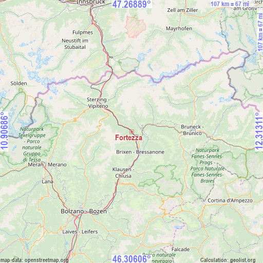
Fortezza GPS coordinates[2]
46° 47' 22.668" North, 11° 36' 35.928" East
| Map corner | latitude | longitude |
|---|---|---|
| Upper-left | 47.26889°, | 10.90686° |
| Center: | 46.78963°, | 11.60998° |
| Lower-right: | 46.30606°, | 12.31311° |
| Map W x H: | 107.1×107.1 km | = 66.5×66.5mi |
| max Lat: | 47.04031° ⇑0.4% North |
| Fortezza: | 46.78963° |
| min Lat: | ⇓99.6% South 35.50142° |
| min Long | Fortezza | max Long |
| 6.69888° | 11.60998° | 18.48682° |
| W 50.7%⇐ | ⇒49.3% E |
Elevation
Elevation of Fortezza is 745 m = 2444 ft, and this is 438.3 m = 1438 ft above average elevation for this country.
| Max E: |
2085 m = 6841 ft | 9% |
| Fortezza | 745 m 2444 ft | |
| Avg. | 306.7 m = 1006 ft | |
Min E: |
-4 m = -13 ft | 91% |
See also: Italy elevation on elevation.city.
Geographical zone
Fortezza is located in North temperate zone (between Tropic of Cancer and the Arctic Circle). Distance of this North polar circle is 2198.7 km =1366.2 mi to North.| Distance of | km | miles | from Fortezza |
|---|---|---|---|
| North Pole | 4804.5 | 2985.4 | to North |
| Arctic Circle | 2198.7 | 1366.2 | to North |
| Tropic Cancer | 2596.6 | 1613.5 | to South |
| Equator | 5202.5 | 3232.7 | to South |


Nearby cities:
15 places around Fortezza: (largest is in red/bold)
• Bressanone
9 km =5.6 mi,  157°
157°
• Leone-Santa Elisabetta
7.1 km =4.4 mi,  154°
154°
• Maranza
4.7 km =2.9 mi,  53°
53°
• Naz-Sciaves - Natz-Schabs
4.8 km =3 mi,  118°
118°
• Novacella
5.9 km =3.7 mi, 150°
• Rio di Pusteria
4.4 km =2.7 mi,  79°
79°
• Rodengo
6.9 km =4.3 mi, 80°
• Rodengo - Rodeneck
6.2 km =3.9 mi,  100°
100°
• Sciaves
4.9 km =3 mi, 118°
• Vallarga
10.7 km =6.6 mi,  56°
56°
• Vandoies - Vintl
8.9 km =5.5 mi,  71°
71°
• Vandoies di Sopra
10.7 km =6.6 mi, 74°
• Vandoies di Sotto
9 km =5.6 mi, 70°
• Varna
6 km =3.7 mi, 159°
• Villa
6.2 km =3.9 mi, 100°
Sources, notices
• [Note1] Compared only with cities in Italy existing in our database
• [Src1] Map data: © OpenStreetMap contributors (CC-BY-SA)
• [Src2] Other city data from geonames.org with taken over terms of usage.
• [Src3] Geographical zone / Annual Mean Temperature by Robert A. Rohde @ Wikipedia
