Prepotto geodata
Prepotto (Friuli Venezia Giulia) is a seat of a third-order administrative division; located in Italy in Europe/Rome (GMT+2) time zone. With population of 128 people, there are 11357 cities with bigger population in this country. Compared to other cities in Italy, 92.9% of cities are located further ↓South; 73.3% of cities are located further ←West and 68.6% of cities have higher elevation than Prepotto. Note1
Administrative division(s):
- Level 1: Friuli Venezia Giulia
- Level 2: Provincia di Udine
- Level 3: Prepotto


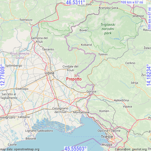
Prepotto GPS coordinates[2]
46° 2' 42.792" North, 13° 28' 45.156" East
| Map corner | latitude | longitude |
|---|---|---|
| Upper-left | 46.5311°, | 12.77609° |
| Center: | 46.04522°, | 13.47921° |
| Lower-right: | 45.55503°, | 14.18234° |
| Map W x H: | 108.5×108.5 km | = 67.4×67.4mi |
| max Lat: | 47.04031° ⇑7.1% North |
| Prepotto: | 46.04522° |
| min Lat: | ⇓92.9% South 35.50142° |
| min Long | Prepotto | max Long |
| 6.69888° | 13.47921° | 18.48682° |
| W 73.3%⇐ | ⇒26.7% E |
Elevation
Elevation of Prepotto is 105 m = 344 ft, and this is 201.7 m = 662 ft below average elevation for this country.
| Max E: |
2085 m = 6841 ft | 68.6% |
| Avg. | 306.7 m = 1006 ft | |
| Prepotto | 105 m = 344 ft | |
Min E: |
-4 m = -13 ft | 31.4% |
See also: Italy elevation on elevation.city.
Geographical zone
Prepotto is located in North temperate zone (between Tropic of Cancer and the Arctic Circle). Distance of this North polar circle is 2281.4 km =1417.6 mi to North.| Distance of | km | miles | from Prepotto |
|---|---|---|---|
| North Pole | 4887.3 | 3036.8 | to North |
| Arctic Circle | 2281.4 | 1417.6 | to North |
| Tropic Cancer | 2513.8 | 1562 | to South |
| Equator | 5119.7 | 3181.2 | to South |


Nearby cities:
15 places around Prepotto: (largest is in red/bold)
• Brazzano
8 km =5 mi,  193°
193°
• Cividale del Friuli
6.3 km =3.9 mi,  322°
322°
• Cormons
10 km =6.2 mi, 185°
• Corno di Rosazzo
6.6 km =4.1 mi,  204°
204°
• Dolegna del Collio
1.6 km =1 mi,  181°
181°
• Dolegnano
7.9 km =4.9 mi,  210°
210°
• Ipplis
5.3 km =3.3 mi,  267°
267°
• Manzano
10.1 km =6.3 mi,  231°
231°
• Merso di Sopra
9.5 km =5.9 mi,  23°
23°
• Moimacco
9.7 km =6 mi,  302°
302°
• Orsaria
7.5 km =4.7 mi,  264°
264°
• Premariacco
6.8 km =4.2 mi,  285°
285°
• San Leonardo
9.1 km =5.7 mi,  25°
25°
• San Pietro al Natisone
7.7 km =4.8 mi,  2°
2°
• Torreano
10 km =6.2 mi,  337°
337°
Sources, notices
• [Note1] Compared only with cities in Italy existing in our database
• [Src1] Map data: © OpenStreetMap contributors (CC-BY-SA)
• [Src2] Other city data from geonames.org with taken over terms of usage.
• [Src3] Geographical zone / Annual Mean Temperature by Robert A. Rohde @ Wikipedia
