Danta geodata
Danta (Veneto) is a seat of a third-order administrative division; located in Italy in Europe/Rome (GMT+2) time zone. With population of 480 people, there are 9990 cities with bigger population in this country. Compared to other cities in Italy, 98.8% of cities are located further ↓South; 62.6% of cities are located further ←West and 99.4% of cities have lower elevation than Danta. Note1


Danta GPS coordinates[2]
46° 34' 1.2" North, 12° 31' 13.98" East
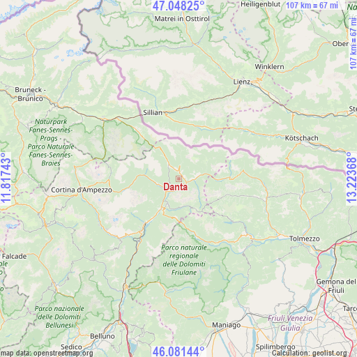
| Map corner | latitude | longitude |
|---|---|---|
| Upper-left | 47.04825°, | 11.81743° |
| Center: | 46.567°, | 12.52055° |
| Lower-right: | 46.08144°, | 13.22368° |
| Map W x H: | 107.5×107.5 km | = 66.8×66.8mi |
| max Lat: | 47.04031° ⇑1.2% North |
| Danta: | 46.567° |
| min Lat: | ⇓98.8% South 35.50142° |
| min Long | Danta | max Long |
| 6.69888° | 12.52055° | 18.48682° |
| W 62.6%⇐ | ⇒37.4% E |
Elevation
Elevation of Danta is 1379 m = 4524 ft, and this is 1072.3 m = 3518 ft above average elevation for this country.
| Max E: |
2085 m = 6841 ft | 0.59999999999999% |
| Danta | 1379 m 4524 ft | |
| Avg. | 306.7 m = 1006 ft | |
Min E: |
-4 m = -13 ft | 99.4% |
See also: Italy elevation on elevation.city.
Geographical zone
Danta is located in North temperate zone (between Tropic of Cancer and the Arctic Circle). Distance of this North polar circle is 2223.4 km =1381.6 mi to North.| Distance of | km | miles | from Danta |
|---|---|---|---|
| North Pole | 4829.3 | 3000.8 | to North |
| Arctic Circle | 2223.4 | 1381.6 | to North |
| Tropic Cancer | 2571.8 | 1598 | to South |
| Equator | 5177.8 | 3217.3 | to South |


Nearby cities:
15 places around Danta: (largest is in red/bold)
• Auronzo
7.4 km =4.6 mi,  263°
263°
• Campolongo
4.6 km =2.9 mi,  93°
93°
• Candide
2.5 km =1.6 mi,  349°
349°
• Domegge di Cadore
15 km =9.3 mi,  215°
215°
• Granvilla
12.9 km =8 mi, 89°
• Laggio di Cadore
8.4 km =5.2 mi,  201°
201°
• Lorenzago di Cadore
10.8 km =6.7 mi,  205°
205°
• Lozzo di Cadore
10.7 km =6.6 mi, 212°
• Padola
5.1 km =3.2 mi,  322°
322°
• San Nicolò Comelico
1.8 km =1.1 mi,  16°
16°
• San Pietro di Cadore
5.1 km =3.2 mi,  83°
83°
• Santo Stefano di Cadore
2.4 km =1.5 mi,  113°
113°
• Sappada
12.5 km =7.8 mi, 90°
• Vico
16.6 km =10.3 mi,  162°
162°
• Vigo di Cadore
8.4 km =5.2 mi, 206°
Sources, notices
• [Note1] Compared only with cities in Italy existing in our database
• [Src1] Map data: © OpenStreetMap contributors (CC-BY-SA)
• [Src2] Other city data from geonames.org with taken over terms of usage.
• [Src3] Geographical zone / Annual Mean Temperature by Robert A. Rohde @ Wikipedia
