Granvilla geodata
Granvilla (Friuli Venezia Giulia) is a populated place; located in Italy in Europe/Rome (GMT+2) time zone. With population of 1,145 people, there are 6129 cities with bigger population in this country. Compared to other cities in Italy, 98.8% of cities are located further ↓South; 64.9% of cities are located further ←West and 99% of cities have lower elevation than Granvilla. Note1
Administrative division(s):
- Level 1: Friuli Venezia Giulia
- Level 2: Provincia di Udine
- Level 3: Sappada


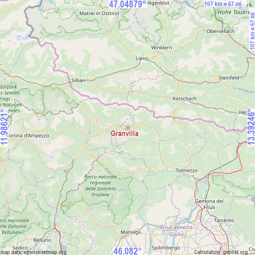
Granvilla GPS coordinates[2]
46° 34' 3.18" North, 12° 41' 21.588" East
| Map corner | latitude | longitude |
|---|---|---|
| Upper-left | 47.04879°, | 11.98621° |
| Center: | 46.56755°, | 12.68933° |
| Lower-right: | 46.082°, | 13.39246° |
| Map W x H: | 107.5×107.5 km | = 66.8×66.8mi |
| max Lat: | 47.04031° ⇑1.2% North |
| Granvilla: | 46.56755° |
| min Lat: | ⇓98.8% South 35.50142° |
| min Long | Granvilla | max Long |
| 6.69888° | 12.68933° | 18.48682° |
| W 64.9%⇐ | ⇒35.1% E |
Elevation
Elevation of Granvilla is 1266 m = 4154 ft, and this is 959.3 m = 3147 ft above average elevation for this country.
| Max E: |
2085 m = 6841 ft | 1% |
| Granvilla | 1266 m 4154 ft | |
| Avg. | 306.7 m = 1006 ft | |
Min E: |
-4 m = -13 ft | 99% |
See also: Italy elevation on elevation.city.
Geographical zone
Granvilla is located in North temperate zone (between Tropic of Cancer and the Arctic Circle). Distance of this North polar circle is 2223.3 km =1381.5 mi to North.| Distance of | km | miles | from Granvilla |
|---|---|---|---|
| North Pole | 4829.2 | 3000.7 | to North |
| Arctic Circle | 2223.3 | 1381.5 | to North |
| Tropic Cancer | 2571.9 | 1598.1 | to South |
| Equator | 5177.8 | 3217.3 | to South |


Nearby cities:
15 places around Granvilla: (largest is in red/bold)
• Campolongo
8.3 km =5.2 mi,  267°
267°
• Candide
13.6 km =8.5 mi,  280°
280°
• Comeglians
14.7 km =9.1 mi,  112°
112°
• Danta
12.9 km =8 mi, 269°
• Forni Avoltri
6.9 km =4.3 mi,  72°
72°
• Ovaro
16.5 km =10.3 mi,  124°
124°
• Padola
16.5 km =10.3 mi, 283°
• Pieria-Prato Carnico
10.2 km =6.3 mi, 121°
• Prato Carnico
10.5 km =6.5 mi, 119°
• Rigolato
12.1 km =7.5 mi,  97°
97°
• San Nicolò Comelico
12.5 km =7.8 mi, 277°
• San Pietro di Cadore
7.8 km =4.8 mi, 273°
• Santo Stefano di Cadore
10.7 km =6.6 mi,  264°
264°
• Sappada
0.4 km =0.2 mi, 255°
• Sauris di Sotto
11.4 km =7.1 mi,  172°
172°
Sources, notices
• [Note1] Compared only with cities in Italy existing in our database
• [Src1] Map data: © OpenStreetMap contributors (CC-BY-SA)
• [Src2] Other city data from geonames.org with taken over terms of usage.
• [Src3] Geographical zone / Annual Mean Temperature by Robert A. Rohde @ Wikipedia
