Candide geodata
Candide (Veneto) is a seat of a third-order administrative division; located in Italy in Europe/Rome (GMT+2) time zone. With population of 836 people, there are 7467 cities with bigger population in this country. Compared to other cities in Italy, 98.8% of cities are located further ↓South; 62.6% of cities are located further ←West and 98.7% of cities have lower elevation than Candide. Note1
Administrative division(s):
- Level 1: Veneto
- Level 2: Provincia di Belluno
- Level 3: Comelico Superiore


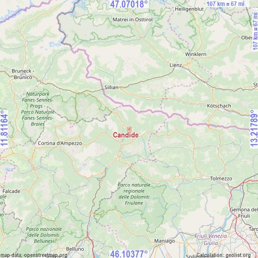
Candide GPS coordinates[2]
46° 35' 20.868" North, 12° 30' 53.136" East
| Map corner | latitude | longitude |
|---|---|---|
| Upper-left | 47.07018°, | 11.81164° |
| Center: | 46.58913°, | 12.51476° |
| Lower-right: | 46.10377°, | 13.21789° |
| Map W x H: | 107.5×107.5 km | = 66.8×66.8mi |
| max Lat: | 47.04031° ⇑1.2% North |
| Candide: | 46.58913° |
| min Lat: | ⇓98.8% South 35.50142° |
| min Long | Candide | max Long |
| 6.69888° | 12.51476° | 18.48682° |
| W 62.6%⇐ | ⇒37.4% E |
Elevation
Elevation of Candide is 1215 m = 3986 ft, and this is 908.3 m = 2980 ft above average elevation for this country.
| Max E: |
2085 m = 6841 ft | 1.3% |
| Candide | 1215 m 3986 ft | |
| Avg. | 306.7 m = 1006 ft | |
Min E: |
-4 m = -13 ft | 98.7% |
See also: Italy elevation on elevation.city.
Geographical zone
Candide is located in North temperate zone (between Tropic of Cancer and the Arctic Circle). Distance of this North polar circle is 2220.9 km =1380 mi to North.| Distance of | km | miles | from Candide |
|---|---|---|---|
| North Pole | 4826.8 | 2999.2 | to North |
| Arctic Circle | 2220.9 | 1380 | to North |
| Tropic Cancer | 2574.3 | 1599.6 | to South |
| Equator | 5180.2 | 3218.8 | to South |


Nearby cities:
15 places around Candide: (largest is in red/bold)
• Auronzo
7.7 km =4.8 mi,  244°
244°
• Campolongo
5.8 km =3.6 mi,  118°
118°
• Danta
2.5 km =1.6 mi,  169°
169°
• Domegge di Cadore
16.9 km =10.5 mi,  209°
209°
• Granvilla
13.6 km =8.5 mi,  100°
100°
• Laggio di Cadore
10.6 km =6.6 mi,  194°
194°
• Lorenzago di Cadore
12.9 km =8 mi,  199°
199°
• Lozzo di Cadore
12.6 km =7.8 mi, 205°
• Padola
3.1 km =1.9 mi,  300°
300°
• San Giuseppe
15.9 km =9.9 mi,  314°
314°
• San Nicolò Comelico
1.2 km =0.7 mi,  127°
127°
• San Pietro di Cadore
5.8 km =3.6 mi,  109°
109°
• Santo Stefano di Cadore
4.3 km =2.7 mi,  142°
142°
• Sappada
13.2 km =8.2 mi, 100°
• Vigo di Cadore
10.6 km =6.6 mi, 198°
In other languages:
- In France: Comelico Superiore
- In German: Comelico Superiore
- In Italian: Comelico Superiore
Sources, notices
• [Note1] Compared only with cities in Italy existing in our database
• [Src1] Map data: © OpenStreetMap contributors (CC-BY-SA)
• [Src2] Other city data from geonames.org with taken over terms of usage.
• [Src3] Geographical zone / Annual Mean Temperature by Robert A. Rohde @ Wikipedia
