Cornuda geodata
Cornuda (Veneto) is a seat of a third-order administrative division; located in Italy in Europe/Rome (GMT+2) time zone. With population of 5,699 people, there are 1723 cities with bigger population in this country. Compared to other cities in Italy, 87.1% of cities are located further ↓South; 55.9% of cities are located further ←West and 59.8% of cities have higher elevation than Cornuda. Note1


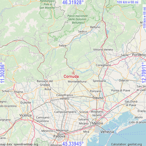
Cornuda GPS coordinates[2]
45° 49' 53.472" North, 12° 0' 21.528" East
| Map corner | latitude | longitude |
|---|---|---|
| Upper-left | 46.31928°, | 11.30286° |
| Center: | 45.83152°, | 12.00598° |
| Lower-right: | 45.33945°, | 12.70911° |
| Map W x H: | 108.9×108.9 km | = 67.7×67.7mi |
| max Lat: | 47.04031° ⇑12.9% North |
| Cornuda: | 45.83152° |
| min Lat: | ⇓87.1% South 35.50142° |
| min Long | Cornuda | max Long |
| 6.69888° | 12.00598° | 18.48682° |
| W 55.9%⇐ | ⇒44.1% E |
Elevation
Elevation of Cornuda is 165 m = 541 ft, and this is 141.7 m = 465 ft below average elevation for this country.
| Max E: |
2085 m = 6841 ft | 59.8% |
| Avg. | 306.7 m = 1006 ft | |
| Cornuda | 165 m = 541 ft | |
Min E: |
-4 m = -13 ft | 40.2% |
See also: Italy elevation on elevation.city.
Geographical zone
Cornuda is located in North temperate zone (between Tropic of Cancer and the Arctic Circle). Distance of this North polar circle is 2305.2 km =1432.4 mi to North.| Distance of | km | miles | from Cornuda |
|---|---|---|---|
| North Pole | 4911.1 | 3051.6 | to North |
| Arctic Circle | 2305.2 | 1432.4 | to North |
| Tropic Cancer | 2490.1 | 1547.3 | to South |
| Equator | 5096 | 3166.5 | to South |


Nearby cities:
15 places around Cornuda: (largest is in red/bold)
• Bigolino
4 km =2.5 mi,  12°
12°
• Caerano di San Marco
5.6 km =3.5 mi,  185°
185°
• Ciano
3.8 km =2.4 mi,  102°
102°
• Covolo-Levada
1.9 km =1.2 mi,  358°
358°
• Crespignaga
6.5 km =4 mi,  229°
229°
• Crocetta del Montello
2.2 km =1.4 mi,  75°
75°
• Crocetta-Nogarè
1.9 km =1.2 mi, 104°
• Maser
3.6 km =2.2 mi,  221°
221°
• Monfumo
6.6 km =4.1 mi,  269°
269°
• Montebelluna
7.1 km =4.4 mi,  152°
152°
• Mosnigo
6.6 km =4.1 mi,  58°
58°
• Muliparte
2.4 km =1.5 mi, 223°
• Onigo
3.1 km =1.9 mi,  337°
337°
• Pederobba
6.6 km =4.1 mi,  318°
318°
• Vidor
4.9 km =3 mi,  37°
37°
Sources, notices
• [Note1] Compared only with cities in Italy existing in our database
• [Src1] Map data: © OpenStreetMap contributors (CC-BY-SA)
• [Src2] Other city data from geonames.org with taken over terms of usage.
• [Src3] Geographical zone / Annual Mean Temperature by Robert A. Rohde @ Wikipedia
