Conselice geodata
Conselice (Emilia-Romagna) is a seat of a third-order administrative division; located in Italy in Europe/Rome (GMT+2) time zone. With population of 4,486 people, there are 2150 cities with bigger population in this country. Compared to other cities in Italy, 51.2% of cities are located further ↓South; 53.6% of cities are located further ←West and 96.6% of cities have higher elevation than Conselice. Note1
Administrative division(s):
- Level 1: Emilia-Romagna
- Level 2: Provincia di Ravenna
- Level 3: Conselice


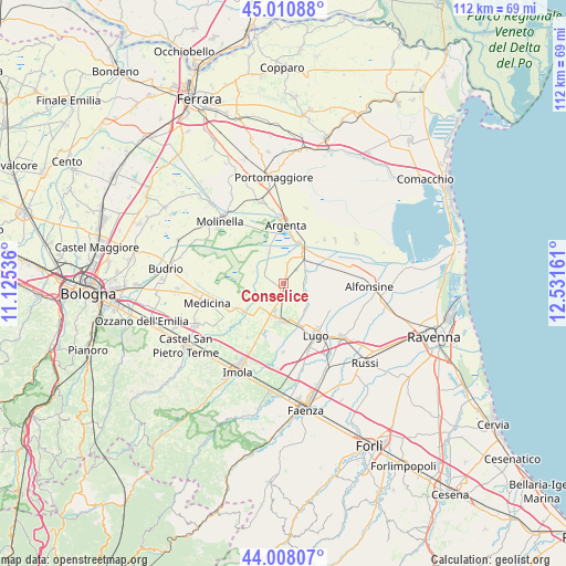
Conselice GPS coordinates[2]
44° 30' 41.868" North, 11° 49' 42.528" East
| Map corner | latitude | longitude |
|---|---|---|
| Upper-left | 45.01088°, | 11.12536° |
| Center: | 44.51163°, | 11.82848° |
| Lower-right: | 44.00807°, | 12.53161° |
| Map W x H: | 111.5×111.5 km | = 69.3×69.3mi |
| max Lat: | 47.04031° ⇑48.8% North |
| Conselice: | 44.51163° |
| min Lat: | ⇓51.2% South 35.50142° |
| min Long | Conselice | max Long |
| 6.69888° | 11.82848° | 18.48682° |
| W 53.6%⇐ | ⇒46.4% E |
Elevation
Elevation of Conselice is 6 m = 20 ft, and this is 300.7 m = 987 ft below average elevation for this country.
| Max E: |
2085 m = 6841 ft | 96.6% |
| Avg. | 306.7 m = 1006 ft | |
| Conselice | 6 m = 20 ft | |
Min E: |
-4 m = -13 ft | 3.4% |
See also: Italy elevation on elevation.city.
Geographical zone
Conselice is located in North temperate zone (between Tropic of Cancer and the Arctic Circle). Distance of this Northern Tropic circle is 2343.3 km =1456.1 mi to South.| Distance of | km | miles | from Conselice |
|---|---|---|---|
| North Pole | 5057.8 | 3142.8 | to North |
| Arctic Circle | 2451.9 | 1523.5 | to North |
| Tropic Cancer | 2343.3 | 1456.1 | to South |
| Equator | 4949.2 | 3075.3 | to South |


Nearby cities:
15 places around Conselice: (largest is in red/bold)
• Argenta
11.4 km =7.1 mi,  2°
2°
• Bubano
11.5 km =7.1 mi,  198°
198°
• Fusignano
11.3 km =7 mi,  116°
116°
• Lavezzola
6.6 km =4.1 mi,  34°
34°
• Lugo
12 km =7.5 mi,  146°
146°
• Masiera
12.3 km =7.6 mi, 116°
• Massa Lombarda
7.2 km =4.5 mi,  184°
184°
• San Bernardino
4.6 km =2.9 mi,  85°
85°
• San Biagio
9 km =5.6 mi,  21°
21°
• San Patrizio
2.2 km =1.4 mi,  186°
186°
• Sant'Agata sul Santerno
8 km =5 mi,  161°
161°
• Sant'Antonio
10.8 km =6.7 mi,  304°
304°
• Sesto Imolese
9.8 km =6.1 mi,  233°
233°
• Villa San Martino
11.1 km =6.9 mi, 163°
• Voltana
9.1 km =5.7 mi,  68°
68°
Sources, notices
• [Note1] Compared only with cities in Italy existing in our database
• [Src1] Map data: © OpenStreetMap contributors (CC-BY-SA)
• [Src2] Other city data from geonames.org with taken over terms of usage.
• [Src3] Geographical zone / Annual Mean Temperature by Robert A. Rohde @ Wikipedia
