Cologna geodata
Cologna (Emilia-Romagna) is a populated place; located in Italy in Europe/Rome (GMT+2) time zone. With population of 865 people, there are 7340 cities with bigger population in this country. Compared to other cities in Italy, 59.3% of cities are located further ↓South; 54.5% of cities are located further ←West and 98.4% of cities have higher elevation than Cologna. Note1
Administrative division(s):
- Level 1: Emilia-Romagna
- Level 2: Provincia di Ferrara
- Level 3: Riva del Po


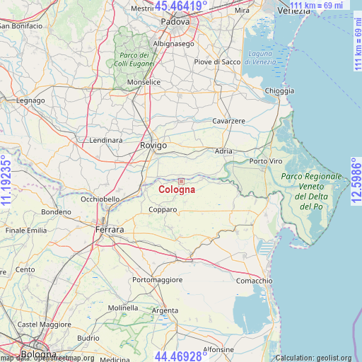
Cologna GPS coordinates[2]
44° 58' 8.004" North, 11° 53' 43.692" East
| Map corner | latitude | longitude |
|---|---|---|
| Upper-left | 45.46419°, | 11.19235° |
| Center: | 44.96889°, | 11.89547° |
| Lower-right: | 44.46928°, | 12.5986° |
| Map W x H: | 110.6×110.6 km | = 68.7×68.7mi |
| max Lat: | 47.04031° ⇑40.7% North |
| Cologna: | 44.96889° |
| min Lat: | ⇓59.3% South 35.50142° |
| min Long | Cologna | max Long |
| 6.69888° | 11.89547° | 18.48682° |
| W 54.5%⇐ | ⇒45.5% E |
Elevation
Elevation of Cologna is 3 m = 10 ft, and this is 303.7 m = 996 ft below average elevation for this country.
| Max E: |
2085 m = 6841 ft | 98.4% |
| Avg. | 306.7 m = 1006 ft | |
| Cologna | 3 m = 10 ft | |
Min E: |
-4 m = -13 ft | 1.6% |
See also: Italy elevation on elevation.city.
Geographical zone
Cologna is located in North temperate zone (between Tropic of Cancer and the Arctic Circle). Distance of this Northern Tropic circle is 2394.2 km =1487.7 mi to South.| Distance of | km | miles | from Cologna |
|---|---|---|---|
| North Pole | 5007 | 3111.2 | to North |
| Arctic Circle | 2401.1 | 1492 | to North |
| Tropic Cancer | 2394.2 | 1487.7 | to South |
| Equator | 5000.1 | 3106.9 | to South |


Nearby cities:
15 places around Cologna: (largest is in red/bold)
• Alberone
5.4 km =3.4 mi,  264°
264°
• Ambrogio
6.5 km =4 mi,  168°
168°
• Berra
6.5 km =4 mi,  82°
82°
• Bosaro
10.8 km =6.7 mi,  287°
287°
• Ceregnano
9.1 km =5.7 mi,  346°
346°
• Coccanile-Cesta
6.2 km =3.9 mi,  201°
201°
• Copparo
10.2 km =6.3 mi,  213°
213°
• Crespino
1.9 km =1.2 mi, 345°
• Gavello
6.4 km =4 mi,  12°
12°
• Guarda Veneta
7.5 km =4.7 mi,  281°
281°
• Lama Pezzoli
8.4 km =5.2 mi, 7°
• Papozze
10.8 km =6.7 mi, 80°
• Pontecchio Polesine
8.6 km =5.3 mi,  311°
311°
• Sant'Apollinare
9.7 km =6 mi,  325°
325°
• Villanova Marchesana
6.2 km =3.9 mi,  65°
65°
Sources, notices
• [Note1] Compared only with cities in Italy existing in our database
• [Src1] Map data: © OpenStreetMap contributors (CC-BY-SA)
• [Src2] Other city data from geonames.org with taken over terms of usage.
• [Src3] Geographical zone / Annual Mean Temperature by Robert A. Rohde @ Wikipedia
