Bortolot geodata
Bortolot (Veneto) is a seat of a third-order administrative division; located in Italy in Europe/Rome (GMT+2) time zone. With population of 271 people, there are 10801 cities with bigger population in this country. Compared to other cities in Italy, 97.5% of cities are located further ↓South; 58.3% of cities are located further ←West and 99.6% of cities have lower elevation than Bortolot. Note1


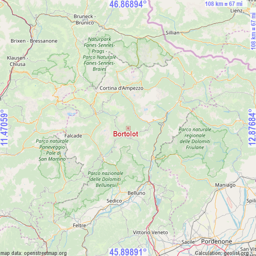
Bortolot GPS coordinates[2]
46° 23' 9.888" North, 12° 10' 25.356" East
| Map corner | latitude | longitude |
|---|---|---|
| Upper-left | 46.86894°, | 11.47059° |
| Center: | 46.38608°, | 12.17371° |
| Lower-right: | 45.89891°, | 12.87684° |
| Map W x H: | 107.9×107.9 km | = 67×67mi |
| max Lat: | 47.04031° ⇑2.5% North |
| Bortolot: | 46.38608° |
| min Lat: | ⇓97.5% South 35.50142° |
| min Long | Bortolot | max Long |
| 6.69888° | 12.17371° | 18.48682° |
| W 58.3%⇐ | ⇒41.7% E |
Elevation
Elevation of Bortolot is 1443 m = 4734 ft, and this is 1136.3 m = 3728 ft above average elevation for this country.
| Max E: |
2085 m = 6841 ft | 0.40000000000001% |
| Bortolot | 1443 m 4734 ft | |
| Avg. | 306.7 m = 1006 ft | |
Min E: |
-4 m = -13 ft | 99.6% |
See also: Italy elevation on elevation.city.
Geographical zone
Bortolot is located in North temperate zone (between Tropic of Cancer and the Arctic Circle). Distance of this North polar circle is 2243.5 km =1394 mi to North.| Distance of | km | miles | from Bortolot |
|---|---|---|---|
| North Pole | 4849.4 | 3013.3 | to North |
| Arctic Circle | 2243.5 | 1394 | to North |
| Tropic Cancer | 2551.7 | 1585.6 | to South |
| Equator | 5157.6 | 3204.8 | to South |


Nearby cities:
15 places around Bortolot: (largest is in red/bold)
• Alleghe
11.8 km =7.3 mi,  281°
281°
• Borca
6.5 km =4 mi,  34°
34°
• Cibiana
8.7 km =5.4 mi,  88°
88°
• Forno di Zoldo
4 km =2.5 mi,  174°
174°
• Fusine
3.9 km =2.4 mi,  252°
252°
• La Valle Agordina
14.1 km =8.8 mi,  214°
214°
• Ospitale di Cadore
13.1 km =8.1 mi,  119°
119°
• Perarolo di Cadore
14 km =8.7 mi, 86°
• San Vito
8.9 km =5.5 mi,  16°
16°
• Selva di Cadore
11.4 km =7.1 mi,  308°
308°
• Valle di Cadore
12.8 km =8 mi,  73°
73°
• Venas
9.9 km =6.2 mi, 74°
• Vodo
6.6 km =4.1 mi,  56°
56°
• Zoldo Alto
3.8 km =2.4 mi, 251°
• Zoppè di Cadore
0 km =0 mi,  184°
184°
Sources, notices
• [Note1] Compared only with cities in Italy existing in our database
• [Src1] Map data: © OpenStreetMap contributors (CC-BY-SA)
• [Src2] Other city data from geonames.org with taken over terms of usage.
• [Src3] Geographical zone / Annual Mean Temperature by Robert A. Rohde @ Wikipedia
