Champdepraz geodata
Champdepraz (Aosta Valley) is a seat of a third-order administrative division; located in Italy in Europe/Rome (GMT+2) time zone. With population of 100 people, there are 11438 cities with bigger population in this country. Compared to other cities in Italy, 80.4% of cities are located further ↓South; 96.6% of cities are located further →East and 81.8% of cities have lower elevation than Champdepraz. Note1


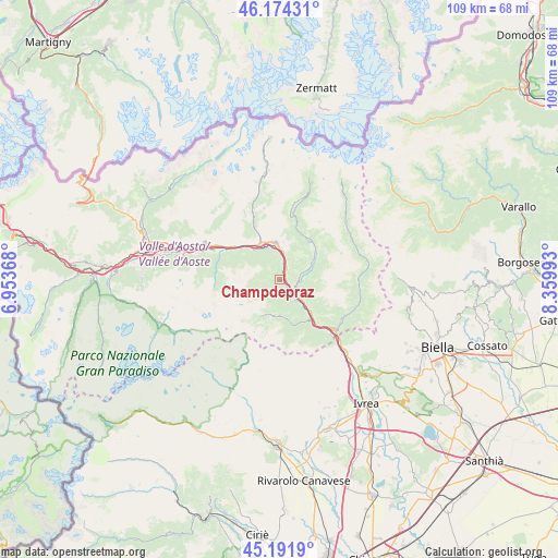
Champdepraz GPS coordinates[2]
45° 41' 6.936" North, 7° 39' 24.516" East
| Map corner | latitude | longitude |
|---|---|---|
| Upper-left | 46.17431°, | 6.95368° |
| Center: | 45.68526°, | 7.65681° |
| Lower-right: | 45.1919°, | 8.35993° |
| Map W x H: | 109.2×109.2 km | = 67.9×67.9mi |
| max Lat: | 47.04031° ⇑19.6% North |
| Champdepraz: | 45.68526° |
| min Lat: | ⇓80.4% South 35.50142° |
| min Long | Champdepraz | max Long |
| 6.69888° | 7.65681° | 18.48682° |
| W 3.4%⇐ | ⇒96.6% E |
Elevation
Elevation of Champdepraz is 550 m = 1804 ft, and this is 243.3 m = 798 ft above average elevation for this country.
| Max E: |
2085 m = 6841 ft | 18.2% |
| Champdepraz | 550 m 1804 ft | |
| Avg. | 306.7 m = 1006 ft | |
Min E: |
-4 m = -13 ft | 81.8% |
See also: Italy elevation on elevation.city.
Geographical zone
Champdepraz is located in North temperate zone (between Tropic of Cancer and the Arctic Circle). Distance of this North polar circle is 2321.4 km =1442.5 mi to North.| Distance of | km | miles | from Champdepraz |
|---|---|---|---|
| North Pole | 4927.3 | 3061.7 | to North |
| Arctic Circle | 2321.4 | 1442.5 | to North |
| Tropic Cancer | 2473.8 | 1537.1 | to South |
| Equator | 5079.7 | 3156.4 | to South |


Nearby cities:
15 places around Champdepraz: (largest is in red/bold)
• Arnad
6.3 km =3.9 mi,  132°
132°
• Berriat
2.9 km =1.8 mi,  31°
31°
• Challand-Saint-Anselme
6.9 km =4.3 mi,  61°
61°
• Challand-Saint-Victor
3.8 km =2.4 mi,  81°
81°
• Champorcher
7.4 km =4.6 mi,  201°
201°
• Chatillon
7.8 km =4.8 mi,  336°
336°
• Emarese
5.1 km =3.2 mi, 30°
• Issogne
4 km =2.5 mi,  146°
146°
• La Place
4.1 km =2.5 mi, 148°
• Lassolaz
7.9 km =4.9 mi,  318°
318°
• Montjovet
2.9 km =1.8 mi, 28°
• Quincod
6.9 km =4.3 mi, 61°
• Saint-Vincent
7.3 km =4.5 mi,  354°
354°
• Verres
3.3 km =2.1 mi, 129°
• Villa-Nabian
3.8 km =2.4 mi, 82°
Sources, notices
• [Note1] Compared only with cities in Italy existing in our database
• [Src1] Map data: © OpenStreetMap contributors (CC-BY-SA)
• [Src2] Other city data from geonames.org with taken over terms of usage.
• [Src3] Geographical zone / Annual Mean Temperature by Robert A. Rohde @ Wikipedia
