Cellio geodata
Cellio (Piedmont) is a seat of a third-order administrative division; located in Italy in Europe/Rome (GMT+2) time zone. With population of 302 people, there are 10666 cities with bigger population in this country. Compared to other cities in Italy, 83.8% of cities are located further ↓South; 90% of cities are located further →East and 88.4% of cities have lower elevation than Cellio. Note1
Administrative division(s):
- Level 1: Piedmont
- Level 2: Provincia di Vercelli
- Level 3: Cellio con Breia


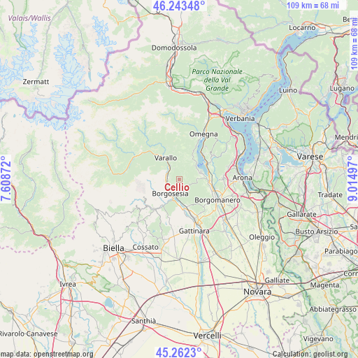
Cellio GPS coordinates[2]
45° 45' 18.18" North, 8° 18' 42.66" East
| Map corner | latitude | longitude |
|---|---|---|
| Upper-left | 46.24348°, | 7.60872° |
| Center: | 45.75505°, | 8.31185° |
| Lower-right: | 45.2623°, | 9.01497° |
| Map W x H: | 109.1×109.1 km | = 67.8×67.8mi |
| max Lat: | 47.04031° ⇑16.2% North |
| Cellio: | 45.75505° |
| min Lat: | ⇓83.8% South 35.50142° |
| min Long | Cellio | max Long |
| 6.69888° | 8.31185° | 18.48682° |
| W 10%⇐ | ⇒90% E |
Elevation
Elevation of Cellio is 679 m = 2228 ft, and this is 372.3 m = 1221 ft above average elevation for this country.
| Max E: |
2085 m = 6841 ft | 11.6% |
| Cellio | 679 m 2228 ft | |
| Avg. | 306.7 m = 1006 ft | |
Min E: |
-4 m = -13 ft | 88.4% |
See also: Italy elevation on elevation.city.
Geographical zone
Cellio is located in North temperate zone (between Tropic of Cancer and the Arctic Circle). Distance of this North polar circle is 2313.7 km =1437.7 mi to North.| Distance of | km | miles | from Cellio |
|---|---|---|---|
| North Pole | 4919.6 | 3056.9 | to North |
| Arctic Circle | 2313.7 | 1437.7 | to North |
| Tropic Cancer | 2481.6 | 1542 | to South |
| Equator | 5087.5 | 3161.2 | to South |


Nearby cities:
15 places around Cellio: (largest is in red/bold)
• Arola
7 km =4.3 mi,  31°
31°
• Borgosesia
4.8 km =3 mi,  216°
216°
• Breia
1.2 km =0.7 mi,  336°
336°
• Civiasco
6 km =3.7 mi,  346°
346°
• Guardabosone
7.6 km =4.7 mi, 219°
• Madonna del Sasso
6.1 km =3.8 mi,  47°
47°
• Pella
7.3 km =4.5 mi, 50°
• Pogno
5.7 km =3.5 mi,  86°
86°
• Quarona
3.5 km =2.2 mi,  279°
279°
• Roccapietra
5 km =3.1 mi,  326°
326°
• San Maurizio D'Opaglio
6.8 km =4.2 mi,  73°
73°
• Serravalle Sesia
7.8 km =4.8 mi,  181°
181°
• Soriso
7.8 km =4.8 mi,  102°
102°
• Valduggia
3.3 km =2.1 mi,  158°
158°
• Varallo
7.7 km =4.8 mi, 327°
Sources, notices
• [Note1] Compared only with cities in Italy existing in our database
• [Src1] Map data: © OpenStreetMap contributors (CC-BY-SA)
• [Src2] Other city data from geonames.org with taken over terms of usage.
• [Src3] Geographical zone / Annual Mean Temperature by Robert A. Rohde @ Wikipedia
