Cecchina geodata
Cecchina (Latium) is a populated place; located in Italy in Europe/Rome (GMT+2) time zone. With population of 9,141 people, there are 1037 cities with bigger population in this country. Compared to other cities in Italy, 72.9% of cities are located further ↑North; 64.3% of cities are located further ←West and 55.1% of cities have lower elevation than Cecchina. Note1
Administrative division(s):
- Level 1: Latium
- Level 2: Città metropolitana di Roma Capitale
- Level 3: Albano Laziale


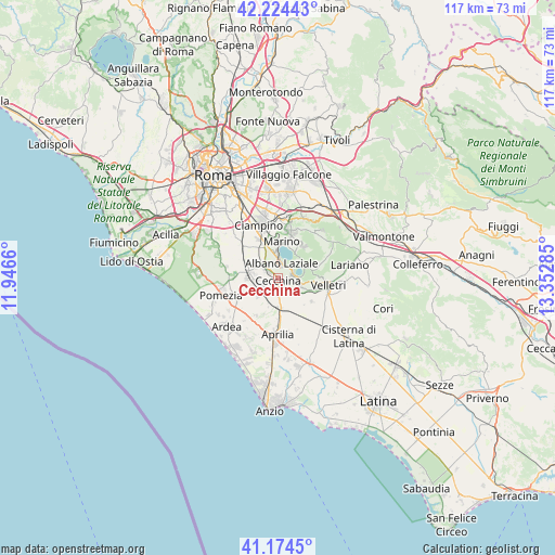
Cecchina GPS coordinates[2]
41° 42' 5.796" North, 12° 38' 58.992" East
| Map corner | latitude | longitude |
|---|---|---|
| Upper-left | 42.22443°, | 11.9466° |
| Center: | 41.70161°, | 12.64972° |
| Lower-right: | 41.1745°, | 13.35285° |
| Map W x H: | 116.7×116.7 km | = 72.5×72.5mi |
| max Lat: | 47.04031° ⇑72.9% North |
| Cecchina: | 41.70161° |
| min Lat: | ⇓27.1% South 35.50142° |
| min Long | Cecchina | max Long |
| 6.69888° | 12.64972° | 18.48682° |
| W 64.3%⇐ | ⇒35.7% E |
Elevation
Elevation of Cecchina is 266 m = 873 ft, and this is 40.7 m = 134 ft below average elevation for this country.
| Max E: |
2085 m = 6841 ft | 44.9% |
| Avg. | 306.7 m = 1006 ft | |
| Cecchina | 266 m = 873 ft | |
Min E: |
-4 m = -13 ft | 55.1% |
See also: Italy elevation on elevation.city.
Geographical zone
Cecchina is located in North temperate zone (between Tropic of Cancer and the Arctic Circle). Distance of this Northern Tropic circle is 2030.9 km =1261.9 mi to South.| Distance of | km | miles | from Cecchina |
|---|---|---|---|
| North Pole | 5370.3 | 3336.9 | to North |
| Arctic Circle | 2764.4 | 1717.7 | to North |
| Tropic Cancer | 2030.9 | 1261.9 | to South |
| Equator | 4636.8 | 2881.2 | to South |


Nearby cities:
15 places around Cecchina: (largest is in red/bold)
• Albano Laziale
3 km =1.9 mi,  14°
14°
• Ariccia
2.8 km =1.7 mi,  41°
41°
• Campoleone
6.2 km =3.9 mi,  181°
181°
• Cancelliera-Massimetta-Pantanelle
3.3 km =2.1 mi,  272°
272°
• Castel Gandolfo
5.2 km =3.2 mi,  0°
0°
• Colli di Cicerone
8.6 km =5.3 mi,  125°
125°
• Genzano di Roma
3.3 km =2.1 mi,  79°
79°
• Lanuvio
4.9 km =3 mi, 130°
• Mantiglia di Ardea
4 km =2.5 mi,  226°
226°
• Marino
7.6 km =4.7 mi, 5°
• Nemi
6.1 km =3.8 mi,  68°
68°
• Pavona
3.9 km =2.4 mi,  314°
314°
• Rocca di Papa
8.3 km =5.2 mi,  31°
31°
• Santa Palomba-Roma II
6.5 km =4 mi, 271°
• Stazione di Pavona-Palazzo Margana
5.3 km =3.3 mi,  291°
291°
Sources, notices
• [Note1] Compared only with cities in Italy existing in our database
• [Src1] Map data: © OpenStreetMap contributors (CC-BY-SA)
• [Src2] Other city data from geonames.org with taken over terms of usage.
• [Src3] Geographical zone / Annual Mean Temperature by Robert A. Rohde @ Wikipedia
