Anzio geodata
Anzio (Latium) is a seat of a third-order administrative division; located in Italy in Europe/Rome (GMT+2) time zone. With population of 45,403 people, there are 151 cities with bigger population in this country. Compared to other cities in Italy, 75.2% of cities are located further ↑North; 64% of cities are located further ←West and 89% of cities have higher elevation than Anzio. Note1
Administrative division(s):
- Level 1: Latium
- Level 2: Città metropolitana di Roma Capitale
- Level 3: Anzio


Anzio GPS coordinates[2]
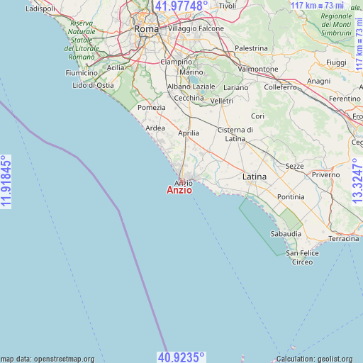
41° 27' 9.468" North, 12° 37' 17.652" East
| Map corner | latitude | longitude |
|---|---|---|
| Upper-left | 41.97748°, | 11.91845° |
| Center: | 41.45263°, | 12.62157° |
| Lower-right: | 40.9235°, | 13.3247° |
| Map W x H: | 117.2×117.2 km | = 72.8×72.8mi |
| max Lat: | 47.04031° ⇑75.2% North |
| Anzio: | 41.45263° |
| min Lat: | ⇓24.8% South 35.50142° |
| min Long | Anzio | max Long |
| 6.69888° | 12.62157° | 18.48682° |
| W 64%⇐ | ⇒36% E |
Elevation
Elevation of Anzio is 20 m = 66 ft, and this is 286.7 m = 941 ft below average elevation for this country.
| Max E: |
2085 m = 6841 ft | 89% |
| Avg. | 306.7 m = 1006 ft | |
| Anzio | 20 m = 66 ft | |
Min E: |
-4 m = -13 ft | 11% |
See also: Anzio elevation on elevation.city.
Geographical zone
Anzio is located in North temperate zone (between Tropic of Cancer and the Arctic Circle). Distance of this Northern Tropic circle is 2003.2 km =1244.7 mi to South.| Distance of | km | miles | from Anzio |
|---|---|---|---|
| North Pole | 5398 | 3354.2 | to North |
| Arctic Circle | 2792.1 | 1734.9 | to North |
| Tropic Cancer | 2003.2 | 1244.7 | to South |
| Equator | 4609.1 | 2864 | to South |


Nearby cities:
15 places around Anzio: (largest is in red/bold)
• Aprilia
16 km =9.9 mi,  9°
9°
• Borgo Bainsizza
14.7 km =9.1 mi,  76°
76°
• Borgo Montello
14.3 km =8.9 mi,  63°
63°
• Borgo Santa Maria
14.7 km =9.1 mi,  86°
86°
• Camilleri-Vallelata
16.2 km =10.1 mi,  358°
358°
• Campo di Carne
11.2 km =7 mi, 8°
• Campoverde
13.5 km =8.4 mi,  44°
44°
• Crocefisso
17.2 km =10.7 mi, 85°
• Fossignano
16.3 km =10.1 mi,  342°
342°
• Genio Civile
12.1 km =7.5 mi,  28°
28°
• Lavinio
6.2 km =3.9 mi,  334°
334°
• Lido dei Pini
9.7 km =6 mi, 344°
• Marina di Ardea-Tor San Lorenzo
13.1 km =8.1 mi, 329°
• Nettuno
3.6 km =2.2 mi, 80°
• Spadellata
8.1 km =5 mi,  354°
354°
Sources, notices
• [Note1] Compared only with cities in Italy existing in our database
• [Src1] Map data: © OpenStreetMap contributors (CC-BY-SA)
• [Src2] Other city data from geonames.org with taken over terms of usage.
• [Src3] Geographical zone / Annual Mean Temperature by Robert A. Rohde @ Wikipedia
