Anterselva di Mezzo geodata
Anterselva di Mezzo (Trentino-Alto Adige) is a populated place; located in Italy in Europe/Rome (GMT+2) time zone. With population of 551 people, there are 9440 cities with bigger population in this country. Compared to other cities in Italy, 99.8% of cities are located further ↓South; 57.3% of cities are located further ←West and 98.9% of cities have lower elevation than Anterselva di Mezzo. Note1


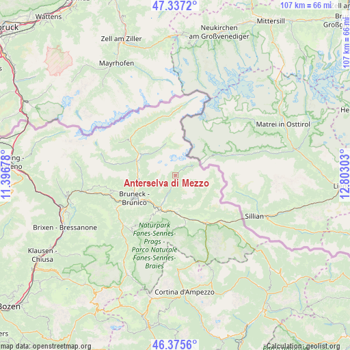
Anterselva di Mezzo GPS coordinates[2]
46° 51' 30.78" North, 12° 5' 59.64" East
| Map corner | latitude | longitude |
|---|---|---|
| Upper-left | 47.3372°, | 11.39678° |
| Center: | 46.85855°, | 12.0999° |
| Lower-right: | 46.3756°, | 12.80303° |
| Map W x H: | 106.9×106.9 km | = 66.4×66.4mi |
| max Lat: | 47.04031° ⇑0.2% North |
| Anterselva di Mezzo: | 46.85855° |
| min Lat: | ⇓99.8% South 35.50142° |
| min Long | Anterselva di M | max Long |
| 6.69888° | 12.0999° | 18.48682° |
| W 57.3%⇐ | ⇒42.7% E |
Elevation
Elevation of Anterselva di Mezzo is 1239 m = 4065 ft, and this is 932.3 m = 3059 ft above average elevation for this country.
| Max E: |
2085 m = 6841 ft | 1.1% |
| Anterselva di Mezzo | 1239 m 4065 ft | |
| Avg. | 306.7 m = 1006 ft | |
Min E: |
-4 m = -13 ft | 98.9% |
See also: Italy elevation on elevation.city.
Geographical zone
Anterselva di Mezzo is located in North temperate zone (between Tropic of Cancer and the Arctic Circle). Distance of this North polar circle is 2191 km =1361.4 mi to North.| Distance of | km | miles | from Anterselva di Mezzo |
|---|---|---|---|
| North Pole | 4796.9 | 2980.7 | to North |
| Arctic Circle | 2191 | 1361.4 | to North |
| Tropic Cancer | 2604.3 | 1618.2 | to South |
| Equator | 5210.2 | 3237.5 | to South |


Nearby cities:
15 places around Anterselva di Mezzo: (largest is in red/bold)
• Brunico
14.2 km =8.8 mi,  242°
242°
• Campo Tures
12 km =7.5 mi,  297°
297°
• Gais
11.7 km =7.3 mi,  257°
257°
• Monguelfo
11.2 km =7 mi,  177°
177°
• Mühlen in Taufers
12.7 km =7.9 mi,  290°
290°
• Perca
11.4 km =7.1 mi,  230°
230°
• Rasun Anterselva - Rasen-Antholz
9.8 km =6.1 mi,  204°
204°
• Rasun di Sopra
8.3 km =5.2 mi, 203°
• San Martino
11 km =6.8 mi,  118°
118°
• Teodone
12.8 km =8 mi, 241°
• Tesido
10 km =6.2 mi,  173°
173°
• Uttenheim
11.6 km =7.2 mi,  273°
273°
• Valdaora di Mezzo
12.2 km =7.6 mi,  206°
206°
• Valdaora di Sotto
11.8 km =7.3 mi, 211°
• Valle di Casies - Gsies
11.7 km =7.3 mi,  148°
148°
Sources, notices
• [Note1] Compared only with cities in Italy existing in our database
• [Src1] Map data: © OpenStreetMap contributors (CC-BY-SA)
• [Src2] Other city data from geonames.org with taken over terms of usage.
• [Src3] Geographical zone / Annual Mean Temperature by Robert A. Rohde @ Wikipedia
