Altedo geodata
Altedo (Emilia-Romagna) is a populated place; located in Italy in Europe/Rome (GMT+2) time zone. With population of 4,549 people, there are 2123 cities with bigger population in this country. Compared to other cities in Italy, 53.7% of cities are located further ↓South; 50.7% of cities are located further →East and 92.1% of cities have higher elevation than Altedo. Note1


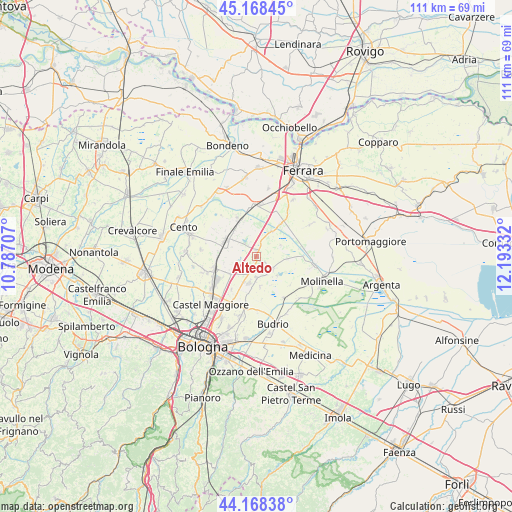
Altedo GPS coordinates[2]
44° 40' 14.052" North, 11° 29' 24.684" East
| Map corner | latitude | longitude |
|---|---|---|
| Upper-left | 45.16845°, | 10.78707° |
| Center: | 44.67057°, | 11.49019° |
| Lower-right: | 44.16838°, | 12.19332° |
| Map W x H: | 111.2×111.2 km | = 69.1×69.1mi |
| max Lat: | 47.04031° ⇑46.3% North |
| Altedo: | 44.67057° |
| min Lat: | ⇓53.7% South 35.50142° |
| min Long | Altedo | max Long |
| 6.69888° | 11.49019° | 18.48682° |
| W 49.3%⇐ | ⇒50.7% E |
Elevation
Elevation of Altedo is 14 m = 46 ft, and this is 292.7 m = 960 ft below average elevation for this country.
| Max E: |
2085 m = 6841 ft | 92.1% |
| Avg. | 306.7 m = 1006 ft | |
| Altedo | 14 m = 46 ft | |
Min E: |
-4 m = -13 ft | 7.9% |
See also: Italy elevation on elevation.city.
Geographical zone
Altedo is located in North temperate zone (between Tropic of Cancer and the Arctic Circle). Distance of this Northern Tropic circle is 2361 km =1467.1 mi to South.| Distance of | km | miles | from Altedo |
|---|---|---|---|
| North Pole | 5040.2 | 3131.8 | to North |
| Arctic Circle | 2434.3 | 1512.6 | to North |
| Tropic Cancer | 2361 | 1467.1 | to South |
| Equator | 4966.9 | 3086.3 | to South |


Nearby cities:
15 places around Altedo: (largest is in red/bold)
• Baricella
4.5 km =2.8 mi,  123°
123°
• Bentivoglio
6.9 km =4.3 mi,  236°
236°
• Boschi
5.8 km =3.6 mi,  66°
66°
• Cà Dè Fabbri
6.3 km =3.9 mi,  206°
206°
• Gallo
8.4 km =5.2 mi,  36°
36°
• Maccaretolo
7.1 km =4.4 mi,  318°
318°
• Malalbergo
6.3 km =3.9 mi,  31°
31°
• Minerbio
6 km =3.7 mi,  193°
193°
• Pegola
2.4 km =1.5 mi,  19°
19°
• San Gabriele-Mondonuovo
7.4 km =4.6 mi,  93°
93°
• San Marino
9.1 km =5.7 mi,  216°
216°
• San Pietro in Casale
7.5 km =4.7 mi,  296°
296°
• San Venanzio
9.3 km =5.8 mi,  333°
333°
• San Vincenzo
8.7 km =5.4 mi, 330°
• Santa Maria in Duno
8.6 km =5.3 mi, 237°
Sources, notices
• [Note1] Compared only with cities in Italy existing in our database
• [Src1] Map data: © OpenStreetMap contributors (CC-BY-SA)
• [Src2] Other city data from geonames.org with taken over terms of usage.
• [Src3] Geographical zone / Annual Mean Temperature by Robert A. Rohde @ Wikipedia
