Ailano geodata
Ailano (Campania) is a seat of a third-order administrative division; located in Italy in Europe/Rome (GMT+2) time zone. With population of 763 people, there are 7862 cities with bigger population in this country. Compared to other cities in Italy, 75.6% of cities are located further ↑North; 79.9% of cities are located further ←West and 50.9% of cities have higher elevation than Ailano. Note1


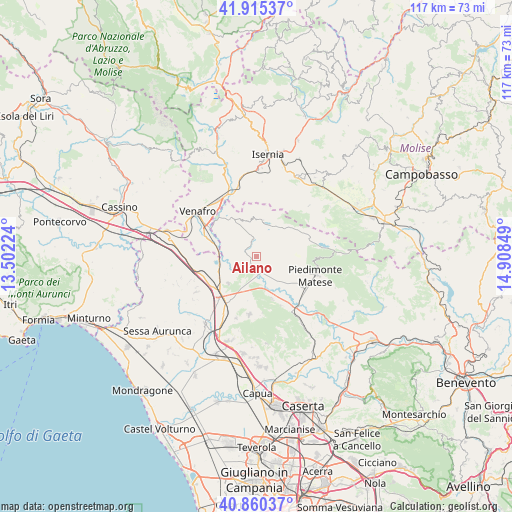
Ailano GPS coordinates[2]
41° 23' 24.036" North, 14° 12' 19.296" East
| Map corner | latitude | longitude |
|---|---|---|
| Upper-left | 41.91537°, | 13.50224° |
| Center: | 41.39001°, | 14.20536° |
| Lower-right: | 40.86037°, | 14.90849° |
| Map W x H: | 117.3×117.3 km | = 72.9×72.9mi |
| max Lat: | 47.04031° ⇑75.6% North |
| Ailano: | 41.39001° |
| min Lat: | ⇓24.4% South 35.50142° |
| min Long | Ailano | max Long |
| 6.69888° | 14.20536° | 18.48682° |
| W 79.9%⇐ | ⇒20.1% E |
Elevation
Elevation of Ailano is 229 m = 751 ft, and this is 77.7 m = 255 ft below average elevation for this country.
| Max E: |
2085 m = 6841 ft | 50.9% |
| Avg. | 306.7 m = 1006 ft | |
| Ailano | 229 m = 751 ft | |
Min E: |
-4 m = -13 ft | 49.1% |
See also: Italy elevation on elevation.city.
Geographical zone
Ailano is located in North temperate zone (between Tropic of Cancer and the Arctic Circle). Distance of this Northern Tropic circle is 1996.2 km =1240.4 mi to South.| Distance of | km | miles | from Ailano |
|---|---|---|---|
| North Pole | 5404.9 | 3358.4 | to North |
| Arctic Circle | 2799 | 1739.2 | to North |
| Tropic Cancer | 1996.2 | 1240.4 | to South |
| Equator | 4602.1 | 2859.6 | to South |


Nearby cities:
15 places around Ailano: (largest is in red/bold)
• Baia
10.3 km =6.4 mi,  158°
158°
• Capriati A Volturno
10 km =6.2 mi,  330°
330°
• Ciorlano
7.8 km =4.8 mi, 329°
• Fontegreca
7.6 km =4.7 mi,  346°
346°
• Gallo
8.5 km =5.3 mi,  11°
11°
• Gallo Matese
8.4 km =5.2 mi, 11°
• Letino
8.2 km =5.1 mi,  30°
30°
• Pietravairano
7.9 km =4.9 mi,  204°
204°
• Prata Sannita Centro
4.8 km =3 mi,  357°
357°
• Pratella
2.8 km =1.7 mi,  308°
308°
• Presenzano
9.6 km =6 mi,  262°
262°
• Raviscanina
3.8 km =2.4 mi,  123°
123°
• Sant'Angelo d'Alife
5.7 km =3.5 mi, 124°
• Vairano-Patenora
8.5 km =5.3 mi,  226°
226°
• Valle Agricola
5.7 km =3.5 mi,  47°
47°
Sources, notices
• [Note1] Compared only with cities in Italy existing in our database
• [Src1] Map data: © OpenStreetMap contributors (CC-BY-SA)
• [Src2] Other city data from geonames.org with taken over terms of usage.
• [Src3] Geographical zone / Annual Mean Temperature by Robert A. Rohde @ Wikipedia
