Falzè-Signoressa geodata
Falzè-Signoressa (Veneto) is a seat of a third-order administrative division; located in Italy in Europe/Rome (GMT+2) time zone. With population of 3,417 people, there are 2743 cities with bigger population in this country. Compared to other cities in Italy, 83.6% of cities are located further ↓South; 57.4% of cities are located further ←West and 73.6% of cities have higher elevation than Falzè-Signoressa. Note1


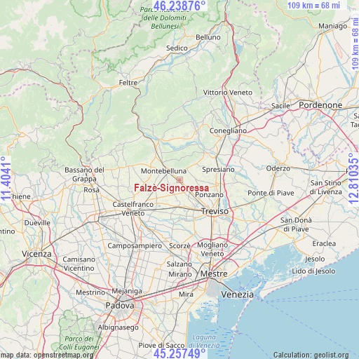
Falzè-Signoressa GPS coordinates[2]
45° 45' 1.008" North, 12° 6' 25.992" East
| Map corner | latitude | longitude |
|---|---|---|
| Upper-left | 46.23876°, | 11.4041° |
| Center: | 45.75028°, | 12.10722° |
| Lower-right: | 45.25749°, | 12.81035° |
| Map W x H: | 109.1×109.1 km | = 67.8×67.8mi |
| max Lat: | 47.04031° ⇑16.4% North |
| Falzè-Signoressa: | 45.75028° |
| min Lat: | ⇓83.6% South 35.50142° |
| min Long | Falzè-Signores | max Long |
| 6.69888° | 12.10722° | 18.48682° |
| W 57.4%⇐ | ⇒42.6% E |
Elevation
Elevation of Falzè-Signoressa is 80 m = 262 ft, and this is 226.7 m = 744 ft below average elevation for this country.
| Max E: |
2085 m = 6841 ft | 73.6% |
| Avg. | 306.7 m = 1006 ft | |
| Falzè-Signoressa | 80 m = 262 ft | |
Min E: |
-4 m = -13 ft | 26.4% |
See also: Italy elevation on elevation.city.
Geographical zone
Falzè-Signoressa is located in North temperate zone (between Tropic of Cancer and the Arctic Circle). Distance of this North polar circle is 2314.2 km =1438 mi to North.| Distance of | km | miles | from Falzè-Signoressa |
|---|---|---|---|
| North Pole | 4920.1 | 3057.2 | to North |
| Arctic Circle | 2314.2 | 1438 | to North |
| Tropic Cancer | 2481 | 1541.6 | to South |
| Equator | 5087 | 3160.9 | to South |


Nearby cities:
15 places around Falzè-Signoressa: (largest is in red/bold)
• Camalò
5 km =3.1 mi,  86°
86°
• Falze
1.3 km =0.8 mi,  237°
237°
• Giavera del Montello
6.7 km =4.2 mi,  43°
43°
• Montebelluna
5.3 km =3.3 mi,  301°
301°
• Musano
2.8 km =1.7 mi,  162°
162°
• Pezzan
6.4 km =4 mi,  187°
187°
• Porcellengo
5.6 km =3.5 mi,  151°
151°
• Postioma
5 km =3.1 mi,  136°
136°
• Sala
5.3 km =3.3 mi, 190°
• San Rocco
7.3 km =4.5 mi,  70°
70°
• Santandrà
7.3 km =4.5 mi, 92°
• Selva del Montello
5.1 km =3.2 mi,  33°
33°
• Trevignano
3.5 km =2.2 mi, 244°
• Venegazzù
3.5 km =2.2 mi,  339°
339°
• Volpago del Montello
3.2 km =2 mi,  16°
16°
Sources, notices
• [Note1] Compared only with cities in Italy existing in our database
• [Src1] Map data: © OpenStreetMap contributors (CC-BY-SA)
• [Src2] Other city data from geonames.org with taken over terms of usage.
• [Src3] Geographical zone / Annual Mean Temperature by Robert A. Rohde @ Wikipedia
