Torreano geodata
Torreano (Friuli Venezia Giulia) is a seat of a third-order administrative division; located in Italy in Europe/Rome (GMT+2) time zone. With population of 939 people, there are 6928 cities with bigger population in this country. Compared to other cities in Italy, 94.5% of cities are located further ↓South; 72.8% of cities are located further ←West and 58.7% of cities have higher elevation than Torreano. Note1
Administrative division(s):
- Level 1: Friuli Venezia Giulia
- Level 2: Provincia di Udine
- Level 3: Torreano


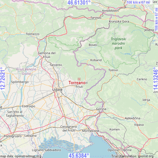
Torreano GPS coordinates[2]
46° 7' 40.296" North, 13° 25' 45.588" East
| Map corner | latitude | longitude |
|---|---|---|
| Upper-left | 46.61301°, | 12.72621° |
| Center: | 46.12786°, | 13.42933° |
| Lower-right: | 45.6384°, | 14.13246° |
| Map W x H: | 108.4×108.4 km | = 67.4×67.4mi |
| max Lat: | 47.04031° ⇑5.5% North |
| Torreano: | 46.12786° |
| min Lat: | ⇓94.5% South 35.50142° |
| min Long | Torreano | max Long |
| 6.69888° | 13.42933° | 18.48682° |
| W 72.8%⇐ | ⇒27.2% E |
Elevation
Elevation of Torreano is 174 m = 571 ft, and this is 132.7 m = 435 ft below average elevation for this country.
| Max E: |
2085 m = 6841 ft | 58.7% |
| Avg. | 306.7 m = 1006 ft | |
| Torreano | 174 m = 571 ft | |
Min E: |
-4 m = -13 ft | 41.3% |
See also: Italy elevation on elevation.city.
Geographical zone
Torreano is located in North temperate zone (between Tropic of Cancer and the Arctic Circle). Distance of this North polar circle is 2272.2 km =1411.9 mi to North.| Distance of | km | miles | from Torreano |
|---|---|---|---|
| North Pole | 4878.1 | 3031.1 | to North |
| Arctic Circle | 2272.2 | 1411.9 | to North |
| Tropic Cancer | 2523 | 1567.7 | to South |
| Equator | 5128.9 | 3186.9 | to South |


Nearby cities:
15 places around Torreano: (largest is in red/bold)
• Campeglio
5.2 km =3.2 mi,  272°
272°
• Cividale del Friuli
4.2 km =2.6 mi,  180°
180°
• Faedis
6.9 km =4.3 mi,  290°
290°
• Ipplis
9.5 km =5.9 mi,  188°
188°
• Merso di Sopra
7.6 km =4.7 mi,  93°
93°
• Moimacco
6 km =3.7 mi,  227°
227°
• Orzano
9.4 km =5.8 mi,  223°
223°
• Premariacco
7.9 km =4.9 mi,  199°
199°
• Prepotto
10 km =6.2 mi,  157°
157°
• Pulfero
6.6 km =4.1 mi,  39°
39°
• Remanzacco
9.4 km =5.8 mi,  239°
239°
• San Leonardo
7.9 km =4.9 mi,  97°
97°
• San Pietro al Natisone
4.4 km =2.7 mi,  109°
109°
• Savogna
8.5 km =5.3 mi,  66°
66°
• Ziracco
6.9 km =4.3 mi,  255°
255°
Sources, notices
• [Note1] Compared only with cities in Italy existing in our database
• [Src1] Map data: © OpenStreetMap contributors (CC-BY-SA)
• [Src2] Other city data from geonames.org with taken over terms of usage.
• [Src3] Geographical zone / Annual Mean Temperature by Robert A. Rohde @ Wikipedia
