Muris geodata
Muris (Friuli Venezia Giulia) is a populated place; located in Italy in Europe/Rome (GMT+2) time zone. With population of 707 people, there are 8250 cities with bigger population in this country. Compared to other cities in Italy, 95.9% of cities are located further ↓South; 68.2% of cities are located further ←West and 52.5% of cities have higher elevation than Muris. Note1
Administrative division(s):
- Level 1: Friuli Venezia Giulia
- Level 2: Provincia di Udine
- Level 3: Ragogna


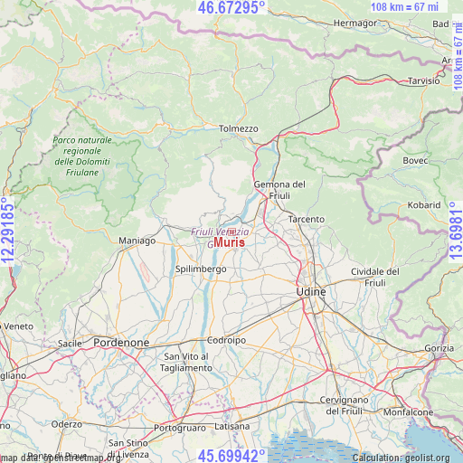
Muris GPS coordinates[2]
46° 11' 18.024" North, 12° 59' 41.892" East
| Map corner | latitude | longitude |
|---|---|---|
| Upper-left | 46.67295°, | 12.29185° |
| Center: | 46.18834°, | 12.99497° |
| Lower-right: | 45.69942°, | 13.6981° |
| Map W x H: | 108.2×108.2 km | = 67.2×67.2mi |
| max Lat: | 47.04031° ⇑4.1% North |
| Muris: | 46.18834° |
| min Lat: | ⇓95.9% South 35.50142° |
| min Long | Muris | max Long |
| 6.69888° | 12.99497° | 18.48682° |
| W 68.2%⇐ | ⇒31.8% E |
Elevation
Elevation of Muris is 219 m = 719 ft, and this is 87.7 m = 288 ft below average elevation for this country.
| Max E: |
2085 m = 6841 ft | 52.5% |
| Avg. | 306.7 m = 1006 ft | |
| Muris | 219 m = 719 ft | |
Min E: |
-4 m = -13 ft | 47.5% |
See also: Italy elevation on elevation.city.
Geographical zone
Muris is located in North temperate zone (between Tropic of Cancer and the Arctic Circle). Distance of this North polar circle is 2265.5 km =1407.7 mi to North.| Distance of | km | miles | from Muris |
|---|---|---|---|
| North Pole | 4871.4 | 3026.9 | to North |
| Arctic Circle | 2265.5 | 1407.7 | to North |
| Tropic Cancer | 2529.7 | 1571.9 | to South |
| Equator | 5135.7 | 3191.2 | to South |


Nearby cities:
15 places around Muris: (largest is in red/bold)
• Anduins
5.7 km =3.5 mi,  330°
330°
• Caporiacco
8.9 km =5.5 mi,  121°
121°
• Carpacco
8.2 km =5.1 mi,  199°
199°
• Clauzetto
7.6 km =4.7 mi,  307°
307°
• Forgaria nel Friuli
3.9 km =2.4 mi,  336°
336°
• Majano
5.1 km =3.2 mi,  91°
91°
• Mels
8.9 km =5.5 mi,  98°
98°
• Paludea
7.2 km =4.5 mi,  279°
279°
• Pinzano al Tagliamento
4 km =2.5 mi,  260°
260°
• Rive d'Arcano
7.4 km =4.6 mi,  157°
157°
• Rodeano
8.7 km =5.4 mi,  171°
171°
• San Daniele del Friuli
3.6 km =2.2 mi, 164°
• San Giacomo
1.9 km =1.2 mi,  207°
207°
• Valeriano
6.1 km =3.8 mi,  247°
247°
• Villanova
6.5 km =4 mi, 196°
Sources, notices
• [Note1] Compared only with cities in Italy existing in our database
• [Src1] Map data: © OpenStreetMap contributors (CC-BY-SA)
• [Src2] Other city data from geonames.org with taken over terms of usage.
• [Src3] Geographical zone / Annual Mean Temperature by Robert A. Rohde @ Wikipedia
