Paludea geodata
Paludea (Friuli Venezia Giulia) is a seat of a third-order administrative division; located in Italy in Europe/Rome (GMT+2) time zone. With population of 226 people, there are 11000 cities with bigger population in this country. Compared to other cities in Italy, 96% of cities are located further ↓South; 67.3% of cities are located further ←West and 50.9% of cities have lower elevation than Paludea. Note1
Administrative division(s):
- Level 1: Friuli Venezia Giulia
- Level 2: Provincia di Pordenone
- Level 3: Castelnovo del Friuli


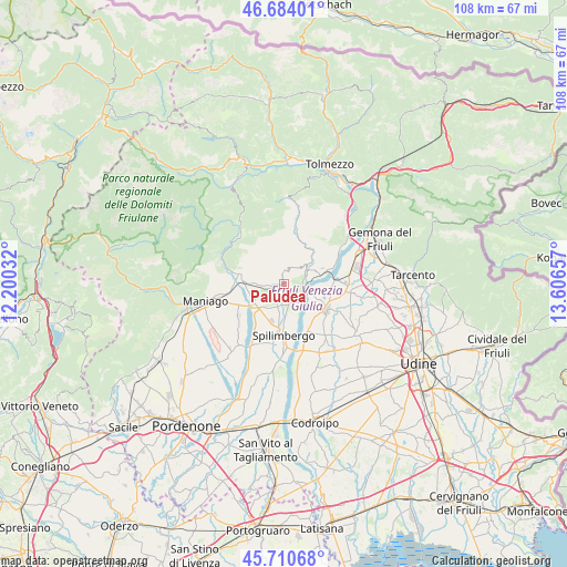
Paludea GPS coordinates[2]
46° 11' 58.2" North, 12° 54' 12.384" East
| Map corner | latitude | longitude |
|---|---|---|
| Upper-left | 46.68401°, | 12.20032° |
| Center: | 46.1995°, | 12.90344° |
| Lower-right: | 45.71068°, | 13.60657° |
| Map W x H: | 108.2×108.2 km | = 67.2×67.2mi |
| max Lat: | 47.04031° ⇑4% North |
| Paludea: | 46.1995° |
| min Lat: | ⇓96% South 35.50142° |
| min Long | Paludea | max Long |
| 6.69888° | 12.90344° | 18.48682° |
| W 67.3%⇐ | ⇒32.7% E |
Elevation
Elevation of Paludea is 240 m = 787 ft, and this is 66.7 m = 219 ft below average elevation for this country.
| Max E: |
2085 m = 6841 ft | 49.1% |
| Avg. | 306.7 m = 1006 ft | |
| Paludea | 240 m = 787 ft | |
Min E: |
-4 m = -13 ft | 50.9% |
See also: Italy elevation on elevation.city.
Geographical zone
Paludea is located in North temperate zone (between Tropic of Cancer and the Arctic Circle). Distance of this North polar circle is 2264.3 km =1407 mi to North.| Distance of | km | miles | from Paludea |
|---|---|---|---|
| North Pole | 4870.2 | 3026.2 | to North |
| Arctic Circle | 2264.3 | 1407 | to North |
| Tropic Cancer | 2531 | 1572.7 | to South |
| Equator | 5136.9 | 3191.9 | to South |


Nearby cities:
15 places around Paludea: (largest is in red/bold)
• Anduins
5.6 km =3.5 mi,  48°
48°
• Clauzetto
3.5 km =2.2 mi,  17°
17°
• Forgaria nel Friuli
6 km =3.7 mi,  67°
67°
• Lestans
4.8 km =3 mi,  193°
193°
• Meduno
8.2 km =5.1 mi,  282°
282°
• Muris
7.2 km =4.5 mi,  99°
99°
• Pinzano al Tagliamento
3.7 km =2.3 mi,  121°
121°
• San Daniele del Friuli
9.3 km =5.8 mi, 120°
• San Giacomo
6.8 km =4.2 mi, 115°
• Sequals
6.9 km =4.3 mi,  234°
234°
• Spilimbergo
9.6 km =6 mi, 185°
• Travesio
2.8 km =1.7 mi,  263°
263°
• Usago
2.7 km =1.7 mi, 229°
• Valeriano
3.9 km =2.4 mi,  158°
158°
• Villanova
9.1 km =5.7 mi,  145°
145°
Sources, notices
• [Note1] Compared only with cities in Italy existing in our database
• [Src1] Map data: © OpenStreetMap contributors (CC-BY-SA)
• [Src2] Other city data from geonames.org with taken over terms of usage.
• [Src3] Geographical zone / Annual Mean Temperature by Robert A. Rohde @ Wikipedia
