Pleyne geodata
Pleyne (Piedmont) is a seat of a third-order administrative division; located in Italy in Europe/Rome (GMT+2) time zone. With population of 12 people, there are 11693 cities with bigger population in this country. Compared to other cities in Italy, 52.2% of cities are located further ↓South; 99.8% of cities are located further →East and 99.8% of cities have lower elevation than Pleyne. Note1


Pleyne GPS coordinates[2]
44° 34' 50.268" North, 7° 1' 1.632" East
| Map corner | latitude | longitude |
|---|---|---|
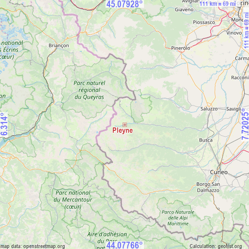
| Upper-left | 45.07928°, | 6.314° |
| Center: | 44.58063°, | 7.01712° |
| Lower-right: | 44.07766°, | 7.72025° |
| Map W x H: | 111.4×111.4 km | = 69.2×69.2mi |
| max Lat: | 47.04031° ⇑47.8% North |
| Pleyne: | 44.58063° |
| min Lat: | ⇓52.2% South 35.50142° |
| min Long | Pleyne | max Long |
| 6.69888° | 7.01712° | 18.48682° |
| W 0.2%⇐ | ⇒99.8% E |
Elevation
Elevation of Pleyne is 1594 m = 5230 ft, and this is 1287.3 m = 4223 ft above average elevation for this country.
| Max E: |
2085 m = 6841 ft | 0.2% |
| Pleyne | 1594 m 5230 ft | |
| Avg. | 306.7 m = 1006 ft | |
Min E: |
-4 m = -13 ft | 99.8% |
See also: Italy elevation on elevation.city.
Geographical zone
Pleyne is located in North temperate zone (between Tropic of Cancer and the Arctic Circle). Distance of this Northern Tropic circle is 2351 km =1460.8 mi to South.| Distance of | km | miles | from Pleyne |
|---|---|---|---|
| North Pole | 5050.2 | 3138 | to North |
| Arctic Circle | 2444.3 | 1518.8 | to North |
| Tropic Cancer | 2351 | 1460.8 | to South |
| Equator | 4956.9 | 3080.1 | to South |


Nearby cities:
15 places around Pleyne: (largest is in red/bold)
• Acceglio
12 km =7.5 mi,  189°
189°
• Canosio
14.8 km =9.2 mi,  159°
159°
• Casteldelfino
4.3 km =2.7 mi,  76°
76°
• Chiesa di Macra
16.9 km =10.5 mi,  130°
130°
• Crissolo
17.2 km =10.7 mi,  39°
39°
• Frassino
20.5 km =12.7 mi,  92°
92°
• Macra
15.7 km =9.8 mi,  124°
124°
• Marmora
14.9 km =9.3 mi, 155°
• Oncino
17.4 km =10.8 mi,  52°
52°
• Ostana
18.5 km =11.5 mi, 47°
• Pontechianale
4.6 km =2.9 mi,  12°
12°
• Prazzo Superiore
11.3 km =7 mi, 164°
• Sampeyre
13.7 km =8.5 mi, 91°
• Serre
7.3 km =4.5 mi, 127°
• Stroppo
12 km =7.5 mi, 133°
Sources, notices
• [Note1] Compared only with cities in Italy existing in our database
• [Src1] Map data: © OpenStreetMap contributors (CC-BY-SA)
• [Src2] Other city data from geonames.org with taken over terms of usage.
• [Src3] Geographical zone / Annual Mean Temperature by Robert A. Rohde @ Wikipedia
