La Valle - Wengen geodata
La Valle - Wengen (Trentino-Alto Adige) is a seat of a third-order administrative division; located in Italy in Europe/Rome (GMT+2) time zone. With population of 1,232 people, there are 5856 cities with bigger population in this country. Compared to other cities in Italy, 99.2% of cities are located further ↓South; 54.8% of cities are located further ←West and 99.3% of cities have lower elevation than La Valle - Wengen. Note1


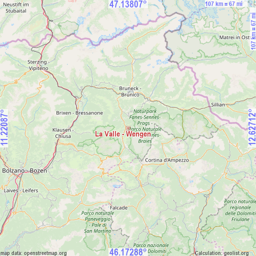
La Valle - Wengen GPS coordinates[2]
46° 39' 27.468" North, 11° 55' 26.364" East
| Map corner | latitude | longitude |
|---|---|---|
| Upper-left | 47.13807°, | 11.22087° |
| Center: | 46.65763°, | 11.92399° |
| Lower-right: | 46.17288°, | 12.62712° |
| Map W x H: | 107.3×107.3 km | = 66.7×66.7mi |
| max Lat: | 47.04031° ⇑0.8% North |
| La Valle - Wengen: | 46.65763° |
| min Lat: | ⇓99.2% South 35.50142° |
| min Long | La Valle - Weng | max Long |
| 6.69888° | 11.92399° | 18.48682° |
| W 54.8%⇐ | ⇒45.2% E |
Elevation
Elevation of La Valle - Wengen is 1347 m = 4419 ft, and this is 1040.3 m = 3413 ft above average elevation for this country.
| Max E: |
2085 m = 6841 ft | 0.7% |
| La Valle - Wengen | 1347 m 4419 ft | |
| Avg. | 306.7 m = 1006 ft | |
Min E: |
-4 m = -13 ft | 99.3% |
See also: Italy elevation on elevation.city.
Geographical zone
La Valle - Wengen is located in North temperate zone (between Tropic of Cancer and the Arctic Circle). Distance of this North polar circle is 2213.3 km =1375.3 mi to North.| Distance of | km | miles | from La Valle - Wengen |
|---|---|---|---|
| North Pole | 4819.2 | 2994.5 | to North |
| Arctic Circle | 2213.3 | 1375.3 | to North |
| Tropic Cancer | 2581.9 | 1604.3 | to South |
| Equator | 5187.8 | 3223.5 | to South |


Nearby cities:
15 places around La Valle - Wengen: (largest is in red/bold)
• Badia
5.9 km =3.7 mi,  201°
201°
• Brunico
15.8 km =9.8 mi,  2°
2°
• Corvara in Badia
12.5 km =7.8 mi, 197°
• La Villa
8.1 km =5 mi,  190°
190°
• Luson - Luesen
15.9 km =9.9 mi,  308°
308°
• Perca
15.8 km =9.8 mi,  16°
16°
• Riscone
13.4 km =8.3 mi,  8°
8°
• San Genesio
0.1 km =0.1 mi,  46°
46°
• San Lorenzo di Sebato
14.2 km =8.8 mi,  355°
355°
• San Martino
13.4 km =8.3 mi,  351°
351°
• San Martino in Badia
3.3 km =2.1 mi,  323°
323°
• San Vigilio
4.6 km =2.9 mi, 6°
• Valdaora di Mezzo
14 km =8.7 mi,  35°
35°
• Valdaora di Sotto
14.2 km =8.8 mi,  30°
30°
• Villa
15.8 km =9.8 mi, 308°
Sources, notices
• [Note1] Compared only with cities in Italy existing in our database
• [Src1] Map data: © OpenStreetMap contributors (CC-BY-SA)
• [Src2] Other city data from geonames.org with taken over terms of usage.
• [Src3] Geographical zone / Annual Mean Temperature by Robert A. Rohde @ Wikipedia
