Cunardo geodata
Cunardo (Lombardy) is a seat of a third-order administrative division; located in Italy in Europe/Rome (GMT+2) time zone. With population of 2,651 people, there are 3369 cities with bigger population in this country. Compared to other cities in Italy, 90.2% of cities are located further ↓South; 84% of cities are located further →East and 73.8% of cities have lower elevation than Cunardo. Note1


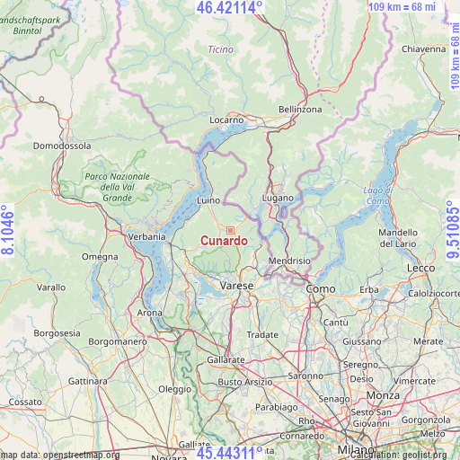
Cunardo GPS coordinates[2]
45° 56' 3.408" North, 8° 48' 27.828" East
| Map corner | latitude | longitude |
|---|---|---|
| Upper-left | 46.42114°, | 8.1046° |
| Center: | 45.93428°, | 8.80773° |
| Lower-right: | 45.44311°, | 9.51085° |
| Map W x H: | 108.7×108.7 km | = 67.5×67.5mi |
| max Lat: | 47.04031° ⇑9.8% North |
| Cunardo: | 45.93428° |
| min Lat: | ⇓90.2% South 35.50142° |
| min Long | Cunardo | max Long |
| 6.69888° | 8.80773° | 18.48682° |
| W 16%⇐ | ⇒84% E |
Elevation
Elevation of Cunardo is 437 m = 1434 ft, and this is 130.3 m = 427 ft above average elevation for this country.
| Max E: |
2085 m = 6841 ft | 26.2% |
| Cunardo | 437 m 1434 ft | |
| Avg. | 306.7 m = 1006 ft | |
Min E: |
-4 m = -13 ft | 73.8% |
See also: Italy elevation on elevation.city.
Geographical zone
Cunardo is located in North temperate zone (between Tropic of Cancer and the Arctic Circle). Distance of this North polar circle is 2293.8 km =1425.3 mi to North.| Distance of | km | miles | from Cunardo |
|---|---|---|---|
| North Pole | 4899.6 | 3044.5 | to North |
| Arctic Circle | 2293.8 | 1425.3 | to North |
| Tropic Cancer | 2501.5 | 1554.4 | to South |
| Equator | 5107.4 | 3173.6 | to South |


Nearby cities:
15 places around Cunardo: (largest is in red/bold)
• Bedero Valcuvia
2.8 km =1.7 mi,  199°
199°
• Brissago-Valtravaglia
5.1 km =3.2 mi,  289°
289°
• Cadegliano-Viconago
3.9 km =2.4 mi,  44°
44°
• Cassano Valcuvia
3 km =1.9 mi,  266°
266°
• Cugliate-Fabiasco
1.5 km =0.9 mi,  33°
33°
• Ferrera di Varese
1.4 km =0.9 mi,  263°
263°
• Ganna
3.8 km =2.4 mi,  158°
158°
• Ghirla
1.5 km =0.9 mi,  133°
133°
• Grantola
3.1 km =1.9 mi,  302°
302°
• Marchirolo
2.5 km =1.6 mi,  52°
52°
• Marzio
3.9 km =2.4 mi,  83°
83°
• Masciago Primo
2.8 km =1.7 mi,  228°
228°
• Mesenzana
3.9 km =2.4 mi, 299°
• Rancio Valcuvia
3.5 km =2.2 mi, 233°
• Valganna
3.8 km =2.4 mi, 161°
Sources, notices
• [Note1] Compared only with cities in Italy existing in our database
• [Src1] Map data: © OpenStreetMap contributors (CC-BY-SA)
• [Src2] Other city data from geonames.org with taken over terms of usage.
• [Src3] Geographical zone / Annual Mean Temperature by Robert A. Rohde @ Wikipedia
