Cassano Valcuvia geodata
Cassano Valcuvia (Lombardy) is a seat of a third-order administrative division; located in Italy in Europe/Rome (GMT+2) time zone. With population of 405 people, there are 10258 cities with bigger population in this country. Compared to other cities in Italy, 90.1% of cities are located further ↓South; 84.5% of cities are located further →East and 60% of cities have lower elevation than Cassano Valcuvia. Note1
Administrative division(s):
- Level 1: Lombardy
- Level 2: Provincia di Varese
- Level 3: Cassano Valcuvia


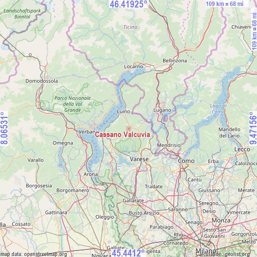
Cassano Valcuvia GPS coordinates[2]
45° 55' 56.568" North, 8° 46' 6.348" East
| Map corner | latitude | longitude |
|---|---|---|
| Upper-left | 46.41925°, | 8.06531° |
| Center: | 45.93238°, | 8.76843° |
| Lower-right: | 45.4412°, | 9.47156° |
| Map W x H: | 108.7×108.7 km | = 67.5×67.5mi |
| max Lat: | 47.04031° ⇑9.9% North |
| Cassano Valcuvia: | 45.93238° |
| min Lat: | ⇓90.1% South 35.50142° |
| min Long | Cassano Valcuvi | max Long |
| 6.69888° | 8.76843° | 18.48682° |
| W 15.5%⇐ | ⇒84.5% E |
Elevation
Elevation of Cassano Valcuvia is 299 m = 981 ft, and this is 7.7 m = 25 ft below average elevation for this country.
| Max E: |
2085 m = 6841 ft | 40% |
| Avg. | 306.7 m = 1006 ft | |
| Cassano Valcuvia | 299 m = 981 ft | |
Min E: |
-4 m = -13 ft | 60% |
See also: Italy elevation on elevation.city.
Geographical zone
Cassano Valcuvia is located in North temperate zone (between Tropic of Cancer and the Arctic Circle). Distance of this North polar circle is 2294 km =1425.4 mi to North.| Distance of | km | miles | from Cassano Valcuvia |
|---|---|---|---|
| North Pole | 4899.9 | 3044.7 | to North |
| Arctic Circle | 2294 | 1425.4 | to North |
| Tropic Cancer | 2501.3 | 1554.2 | to South |
| Equator | 5107.2 | 3173.5 | to South |


Nearby cities:
15 places around Cassano Valcuvia: (largest is in red/bold)
• Bedero Valcuvia
3.2 km =2 mi,  138°
138°
• Brissago-Valtravaglia
2.6 km =1.6 mi,  317°
317°
• Castello Cabiaglio
4.4 km =2.7 mi,  190°
190°
• Cugliate-Fabiasco
4.2 km =2.6 mi,  69°
69°
• Cunardo
3 km =1.9 mi,  86°
86°
• Cuveglio
4 km =2.5 mi,  222°
222°
• Duno
3.1 km =1.9 mi,  229°
229°
• Ferrera di Varese
1.6 km =1 mi, 88°
• Ghirla
4.2 km =2.6 mi,  101°
101°
• Grantola
1.9 km =1.2 mi,  13°
13°
• Masciago Primo
1.9 km =1.2 mi,  148°
148°
• Mesenzana
2.2 km =1.4 mi,  351°
351°
• Montegrino Valtravaglia
4.6 km =2.9 mi,  359°
359°
• Piano
3.7 km =2.3 mi,  341°
341°
• Rancio Valcuvia
1.8 km =1.1 mi,  172°
172°
Sources, notices
• [Note1] Compared only with cities in Italy existing in our database
• [Src1] Map data: © OpenStreetMap contributors (CC-BY-SA)
• [Src2] Other city data from geonames.org with taken over terms of usage.
• [Src3] Geographical zone / Annual Mean Temperature by Robert A. Rohde @ Wikipedia
