Boltiere geodata
Boltiere (Lombardy) is a seat of a third-order administrative division; located in Italy in Europe/Rome (GMT+2) time zone. With population of 5,568 people, there are 1764 cities with bigger population in this country. Compared to other cities in Italy, 77.1% of cities are located further ↓South; 72.3% of cities are located further →East and 58.9% of cities have higher elevation than Boltiere. Note1


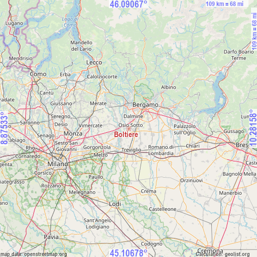
Boltiere GPS coordinates[2]
45° 36' 3.168" North, 9° 34' 42.42" East
| Map corner | latitude | longitude |
|---|---|---|
| Upper-left | 46.09067°, | 8.87533° |
| Center: | 45.60088°, | 9.57845° |
| Lower-right: | 45.10678°, | 10.28158° |
| Map W x H: | 109.4×109.4 km | = 68×68mi |
| max Lat: | 47.04031° ⇑22.9% North |
| Boltiere: | 45.60088° |
| min Lat: | ⇓77.1% South 35.50142° |
| min Long | Boltiere | max Long |
| 6.69888° | 9.57845° | 18.48682° |
| W 27.7%⇐ | ⇒72.3% E |
Elevation
Elevation of Boltiere is 172 m = 564 ft, and this is 134.7 m = 442 ft below average elevation for this country.
| Max E: |
2085 m = 6841 ft | 58.9% |
| Avg. | 306.7 m = 1006 ft | |
| Boltiere | 172 m = 564 ft | |
Min E: |
-4 m = -13 ft | 41.1% |
See also: Italy elevation on elevation.city.
Geographical zone
Boltiere is located in North temperate zone (between Tropic of Cancer and the Arctic Circle). Distance of this North polar circle is 2330.8 km =1448.3 mi to North.| Distance of | km | miles | from Boltiere |
|---|---|---|---|
| North Pole | 4936.7 | 3067.5 | to North |
| Arctic Circle | 2330.8 | 1448.3 | to North |
| Tropic Cancer | 2464.4 | 1531.3 | to South |
| Equator | 5070.3 | 3150.5 | to South |


Nearby cities:
15 places around Boltiere: (largest is in red/bold)
• Arcene
3.9 km =2.4 mi,  133°
133°
• Brembate
1.9 km =1.2 mi,  282°
282°
• Canonica d'Adda
4 km =2.5 mi,  225°
225°
• Capriate San Gervasio
4 km =2.5 mi,  289°
289°
• Ciserano
2.3 km =1.4 mi, 129°
• Filago
4.4 km =2.7 mi,  337°
337°
• Grignano
3.4 km =2.1 mi,  304°
304°
• Levate
4.5 km =2.8 mi,  52°
52°
• Marne
3 km =1.9 mi,  328°
328°
• Osio Sopra
3.2 km =2 mi,  8°
8°
• Osio Sotto
1.9 km =1.2 mi,  26°
26°
• Pontirolo Nuovo
3.6 km =2.2 mi,  191°
191°
• Vaprio d'Adda
5 km =3.1 mi,  237°
237°
• Verdellino
2.3 km =1.4 mi,  89°
89°
• Verdello
3.9 km =2.4 mi, 85°
Sources, notices
• [Note1] Compared only with cities in Italy existing in our database
• [Src1] Map data: © OpenStreetMap contributors (CC-BY-SA)
• [Src2] Other city data from geonames.org with taken over terms of usage.
• [Src3] Geographical zone / Annual Mean Temperature by Robert A. Rohde @ Wikipedia
