Premolo geodata
Premolo (Lombardy) is a seat of a third-order administrative division; located in Italy in Europe/Rome (GMT+2) time zone. With population of 1,118 people, there are 6220 cities with bigger population in this country. Compared to other cities in Italy, 88.2% of cities are located further ↓South; 69.1% of cities are located further →East and 86.2% of cities have lower elevation than Premolo. Note1


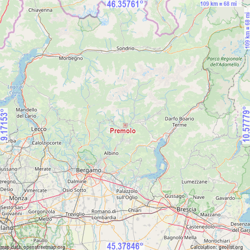
Premolo GPS coordinates[2]
45° 52' 12.684" North, 9° 52' 28.776" East
| Map corner | latitude | longitude |
|---|---|---|
| Upper-left | 46.35761°, | 9.17153° |
| Center: | 45.87019°, | 9.87466° |
| Lower-right: | 45.37846°, | 10.57779° |
| Map W x H: | 108.9×108.9 km | = 67.7×67.7mi |
| max Lat: | 47.04031° ⇑11.8% North |
| Premolo: | 45.87019° |
| min Lat: | ⇓88.2% South 35.50142° |
| min Long | Premolo | max Long |
| 6.69888° | 9.87466° | 18.48682° |
| W 30.9%⇐ | ⇒69.1% E |
Elevation
Elevation of Premolo is 636 m = 2087 ft, and this is 329.3 m = 1080 ft above average elevation for this country.
| Max E: |
2085 m = 6841 ft | 13.8% |
| Premolo | 636 m 2087 ft | |
| Avg. | 306.7 m = 1006 ft | |
Min E: |
-4 m = -13 ft | 86.2% |
See also: Italy elevation on elevation.city.
Geographical zone
Premolo is located in North temperate zone (between Tropic of Cancer and the Arctic Circle). Distance of this North polar circle is 2300.9 km =1429.7 mi to North.| Distance of | km | miles | from Premolo |
|---|---|---|---|
| North Pole | 4906.8 | 3048.9 | to North |
| Arctic Circle | 2300.9 | 1429.7 | to North |
| Tropic Cancer | 2494.4 | 1549.9 | to South |
| Equator | 5100.3 | 3169.2 | to South |


Nearby cities:
15 places around Premolo: (largest is in red/bold)
• Casnigo
6.4 km =4 mi,  184°
184°
• Cazzano Sant'Andrea
6.6 km =4.1 mi,  173°
173°
• Clusone
5.9 km =3.7 mi,  71°
71°
• Colzate
6.1 km =3.8 mi,  193°
193°
• Gandino
6.8 km =4.2 mi,  164°
164°
• Gorno
2.7 km =1.7 mi,  251°
251°
• Oltressenda Alta
7.4 km =4.6 mi,  47°
47°
• Oneta
4.3 km =2.7 mi,  271°
271°
• Parre
1.3 km =0.8 mi, 68°
• Piario
5 km =3.1 mi, 54°
• Ponte Nossa
0.8 km =0.5 mi,  123°
123°
• Vertova
7 km =4.3 mi,  196°
196°
• Villa d'Ogna
5.8 km =3.6 mi, 48°
• Villa d'Oneta
4.3 km =2.7 mi, 270°
• Villassio
2.5 km =1.6 mi, 251°
Sources, notices
• [Note1] Compared only with cities in Italy existing in our database
• [Src1] Map data: © OpenStreetMap contributors (CC-BY-SA)
• [Src2] Other city data from geonames.org with taken over terms of usage.
• [Src3] Geographical zone / Annual Mean Temperature by Robert A. Rohde @ Wikipedia
