Monvalle geodata
Monvalle (Lombardy) is a seat of a third-order administrative division; located in Italy in Europe/Rome (GMT+2) time zone. With population of 1,863 people, there are 4391 cities with bigger population in this country. Compared to other cities in Italy, 87.9% of cities are located further ↓South; 86.4% of cities are located further →East and 50.2% of cities have higher elevation than Monvalle. Note1


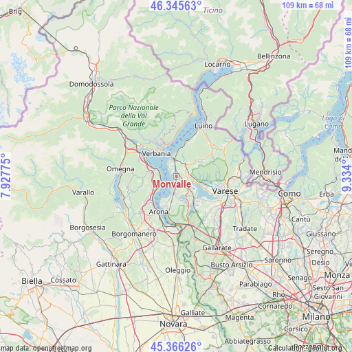
Monvalle GPS coordinates[2]
45° 51' 29.16" North, 8° 37' 51.168" East
| Map corner | latitude | longitude |
|---|---|---|
| Upper-left | 46.34563°, | 7.92775° |
| Center: | 45.8581°, | 8.63088° |
| Lower-right: | 45.36626°, | 9.334° |
| Map W x H: | 108.9×108.9 km | = 67.7×67.7mi |
| max Lat: | 47.04031° ⇑12.1% North |
| Monvalle: | 45.8581° |
| min Lat: | ⇓87.9% South 35.50142° |
| min Long | Monvalle | max Long |
| 6.69888° | 8.63088° | 18.48682° |
| W 13.6%⇐ | ⇒86.4% E |
Elevation
Elevation of Monvalle is 234 m = 768 ft, and this is 72.7 m = 239 ft below average elevation for this country.
| Max E: |
2085 m = 6841 ft | 50.2% |
| Avg. | 306.7 m = 1006 ft | |
| Monvalle | 234 m = 768 ft | |
Min E: |
-4 m = -13 ft | 49.8% |
See also: Italy elevation on elevation.city.
Geographical zone
Monvalle is located in North temperate zone (between Tropic of Cancer and the Arctic Circle). Distance of this North polar circle is 2302.2 km =1430.5 mi to North.| Distance of | km | miles | from Monvalle |
|---|---|---|---|
| North Pole | 4908.1 | 3049.8 | to North |
| Arctic Circle | 2302.2 | 1430.5 | to North |
| Tropic Cancer | 2493 | 1549.1 | to South |
| Equator | 5098.9 | 3168.3 | to South |


Nearby cities:
15 places around Monvalle: (largest is in red/bold)
• Bardello
5.7 km =3.5 mi,  115°
115°
• Belgirate
5 km =3.1 mi,  248°
248°
• Besozzo
2.8 km =1.7 mi,  111°
111°
• Brebbia
3.5 km =2.2 mi,  154°
154°
• Bregano
5.7 km =3.5 mi,  129°
129°
• Brenta
5.7 km =3.5 mi,  45°
45°
• Caldana
5 km =3.1 mi,  72°
72°
• Caravate
2.9 km =1.8 mi,  38°
38°
• Cittiglio
5 km =3.1 mi,  32°
32°
• Cocquio
4.5 km =2.8 mi,  83°
83°
• Gemonio
4.1 km =2.5 mi,  55°
55°
• Ispra
5 km =3.1 mi,  196°
196°
• Leggiuno
2.1 km =1.3 mi,  338°
338°
• Malgesso
4.8 km =3 mi, 134°
• Sangiano
1.9 km =1.2 mi,  5°
5°
Sources, notices
• [Note1] Compared only with cities in Italy existing in our database
• [Src1] Map data: © OpenStreetMap contributors (CC-BY-SA)
• [Src2] Other city data from geonames.org with taken over terms of usage.
• [Src3] Geographical zone / Annual Mean Temperature by Robert A. Rohde @ Wikipedia
