Fornace geodata
Fornace (Trentino-Alto Adige) is a seat of a third-order administrative division; located in Italy in Europe/Rome (GMT+2) time zone. With population of 1,067 people, there are 6411 cities with bigger population in this country. Compared to other cities in Italy, 94.3% of cities are located further ↓South; 54.4% of cities are located further →East and 89.9% of cities have lower elevation than Fornace. Note1
Administrative division(s):
- Level 1: Trentino-Alto Adige
- Level 2: Provincia autonoma di Trento
- Level 3: Fornace


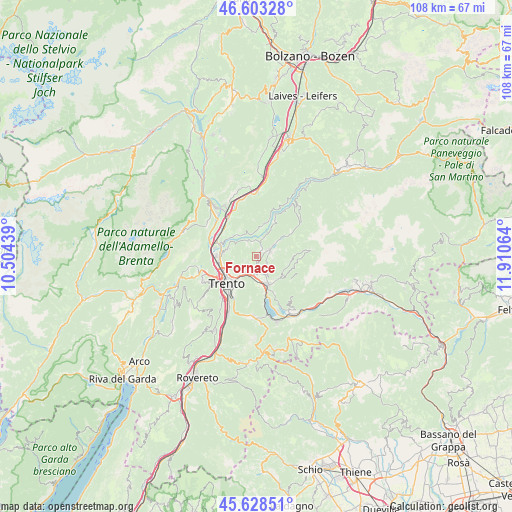
Fornace GPS coordinates[2]
46° 7' 4.98" North, 11° 12' 27.036" East
| Map corner | latitude | longitude |
|---|---|---|
| Upper-left | 46.60328°, | 10.50439° |
| Center: | 46.11805°, | 11.20751° |
| Lower-right: | 45.62851°, | 11.91064° |
| Map W x H: | 108.4×108.4 km | = 67.4×67.4mi |
| max Lat: | 47.04031° ⇑5.7% North |
| Fornace: | 46.11805° |
| min Lat: | ⇓94.3% South 35.50142° |
| min Long | Fornace | max Long |
| 6.69888° | 11.20751° | 18.48682° |
| W 45.6%⇐ | ⇒54.4% E |
Elevation
Elevation of Fornace is 719 m = 2359 ft, and this is 412.3 m = 1353 ft above average elevation for this country.
| Max E: |
2085 m = 6841 ft | 10.1% |
| Fornace | 719 m 2359 ft | |
| Avg. | 306.7 m = 1006 ft | |
Min E: |
-4 m = -13 ft | 89.9% |
See also: Italy elevation on elevation.city.
Geographical zone
Fornace is located in North temperate zone (between Tropic of Cancer and the Arctic Circle). Distance of this North polar circle is 2273.3 km =1412.6 mi to North.| Distance of | km | miles | from Fornace |
|---|---|---|---|
| North Pole | 4879.2 | 3031.8 | to North |
| Arctic Circle | 2273.3 | 1412.6 | to North |
| Tropic Cancer | 2521.9 | 1567 | to South |
| Equator | 5127.8 | 3186.3 | to South |


Nearby cities:
15 places around Fornace: (largest is in red/bold)
• Albiano
3.1 km =1.9 mi,  341°
341°
• Baselga di Pinè
3.4 km =2.1 mi,  61°
61°
• Civezzano
3.5 km =2.2 mi,  210°
210°
• Giovo
6 km =3.7 mi,  314°
314°
• Lases
3.2 km =2 mi,  16°
16°
• Lisignago
5 km =3.1 mi, 342°
• Lona-Lases
3.1 km =1.9 mi, 17°
• Madrano-Canzolino
3.8 km =2.4 mi,  168°
168°
• Miola di Pinè
3.3 km =2.1 mi,  73°
73°
• Rizzolaga-Campolongo
6.1 km =3.8 mi, 55°
• Seregnano
3.1 km =1.9 mi,  194°
194°
• Tavernaro
5.6 km =3.5 mi,  225°
225°
• Verla
6.1 km =3.8 mi,  316°
316°
• Vigo Meano
5.9 km =3.7 mi,  286°
286°
• Villamontagna
5.1 km =3.2 mi, 226°
Sources, notices
• [Note1] Compared only with cities in Italy existing in our database
• [Src1] Map data: © OpenStreetMap contributors (CC-BY-SA)
• [Src2] Other city data from geonames.org with taken over terms of usage.
• [Src3] Geographical zone / Annual Mean Temperature by Robert A. Rohde @ Wikipedia
