Chiusa di San Michele geodata
Chiusa di San Michele (Piedmont) is a seat of a third-order administrative division; located in Italy in Europe/Rome (GMT+2) time zone. With population of 1,631 people, there are 4823 cities with bigger population in this country. Compared to other cities in Italy, 62.5% of cities are located further ↓South; 98.8% of cities are located further →East and 67.5% of cities have lower elevation than Chiusa di San Michele. Note1
Current local time in Chiusa di San Michele:
06:39 PM, WednesdayDifference from your time zone: hours


Chiusa di San Michele GPS coordinates[2]
45° 6' 15.264" North, 7° 19' 37.596" East
| Map corner | latitude | longitude |
|---|---|---|
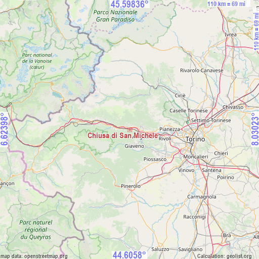
| Upper-left | 45.59836°, | 6.62398° |
| Center: | 45.10424°, | 7.32711° |
| Lower-right: | 44.6058°, | 8.03023° |
| Map W x H: | 110.4×110.4 km | = 68.6×68.6mi |
| max Lat: | 47.04031° ⇑37.5% North |
| Chiusa di San Michele: | 45.10424° |
| min Lat: | ⇓62.5% South 35.50142° |
| min Long | Chiusa di San M | max Long |
| 6.69888° | 7.32711° | 18.48682° |
| W 1.2%⇐ | ⇒98.8% E |
Elevation
Elevation of Chiusa di San Michele is 368 m = 1207 ft, and this is 61.3 m = 201 ft above average elevation for this country.
| Max E: |
2085 m = 6841 ft | 32.5% |
| Chiusa di San Michele | 368 m 1207 ft | |
| Avg. | 306.7 m = 1006 ft | |
Min E: |
-4 m = -13 ft | 67.5% |
See also: Italy elevation on elevation.city.
Geographical zone
Chiusa di San Michele is located in North temperate zone (between Tropic of Cancer and the Arctic Circle). Distance of this North polar circle is 2386.1 km =1482.7 mi to North.| Distance of | km | miles | from Chiusa di San Michele |
|---|---|---|---|
| North Pole | 4991.9 | 3101.8 | to North |
| Arctic Circle | 2386.1 | 1482.7 | to North |
| Tropic Cancer | 2409.2 | 1497 | to South |
| Equator | 5015.1 | 3116.2 | to South |


Nearby cities:
15 places around Chiusa di San Michele: (largest is in red/bold)
• Almese-Rivera
6 km =3.7 mi,  74°
74°
• Avigliana
6.1 km =3.8 mi,  116°
116°
• Caprie
1.8 km =1.1 mi,  15°
15°
• Coazze
6.2 km =3.9 mi,  199°
199°
• Condove
1.9 km =1.2 mi,  311°
311°
• Giaveno
6.8 km =4.2 mi,  166°
166°
• Novaretto
2.7 km =1.7 mi,  55°
55°
• Pontepietra
6.8 km =4.2 mi,  185°
185°
• Rubiana
5.7 km =3.5 mi,  51°
51°
• Sant'Ambrogio di Torino
3.2 km =2 mi,  106°
106°
• Sant'Antonino di Susa
4.2 km =2.6 mi,  275°
275°
• Vaie
3 km =1.9 mi,  265°
265°
• Valgioie
4.8 km =3 mi,  158°
158°
• Villar Dora
4.6 km =2.9 mi,  75°
75°
• Villar Focchiardo
7 km =4.3 mi, 277°
Sources, notices
• [Note1] Compared only with cities in Italy existing in our database
• [Src1] Map data: © OpenStreetMap contributors (CC-BY-SA)
• [Src2] Other city data from geonames.org with taken over terms of usage.
• [Src3] Geographical zone / Annual Mean Temperature by Robert A. Rohde @ Wikipedia
