Cantagrillo-Casalguidi geodata
Cantagrillo-Casalguidi (Tuscany) is a populated place; located in Italy in Europe/Rome (GMT+2) time zone. With population of 6,532 people, there are 1494 cities with bigger population in this country. Compared to other cities in Italy, 56.1% of cities are located further ↑North; 58.3% of cities are located further →East and 74.5% of cities have higher elevation than Cantagrillo-Casalguidi. Note1
Administrative division(s):
- Level 1: Tuscany
- Level 2: Provincia di Pistoia
- Level 3: Serravalle Pistoiese
Current local time in Cantagrillo-Casalguidi:
06:28 PM, WednesdayDifference from your time zone: hours


Cantagrillo-Casalguidi GPS coordinates[2]
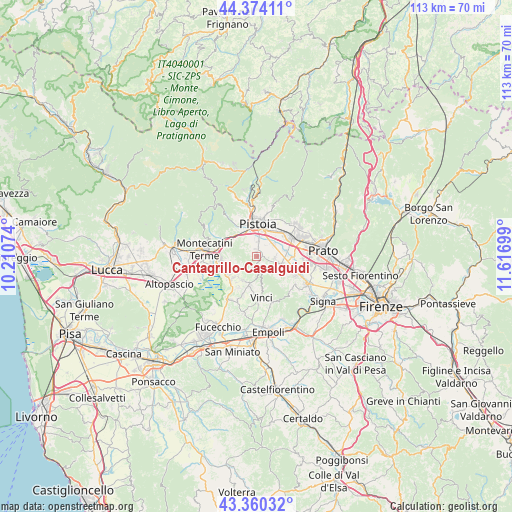
43° 52' 9.732" North, 10° 54' 49.896" East
| Map corner | latitude | longitude |
|---|---|---|
| Upper-left | 44.37411°, | 10.21074° |
| Center: | 43.86937°, | 10.91386° |
| Lower-right: | 43.36032°, | 11.61699° |
| Map W x H: | 112.7×112.7 km | = 70×70mi |
| max Lat: | 47.04031° ⇑56.1% North |
| Cantagrillo-Casalguidi: | 43.86937° |
| min Lat: | ⇓43.9% South 35.50142° |
| min Long | Cantagrillo-Cas | max Long |
| 6.69888° | 10.91386° | 18.48682° |
| W 41.7%⇐ | ⇒58.3% E |
Elevation
Elevation of Cantagrillo-Casalguidi is 76 m = 249 ft, and this is 230.7 m = 757 ft below average elevation for this country.
| Max E: |
2085 m = 6841 ft | 74.5% |
| Avg. | 306.7 m = 1006 ft | |
| Cantagrillo-Casalguidi | 76 m = 249 ft | |
Min E: |
-4 m = -13 ft | 25.5% |
See also: Italy elevation on elevation.city.
Geographical zone
Cantagrillo-Casalguidi is located in North temperate zone (between Tropic of Cancer and the Arctic Circle). Distance of this Northern Tropic circle is 2271.9 km =1411.7 mi to South.| Distance of | km | miles | from Cantagrillo-Casalguidi |
|---|---|---|---|
| North Pole | 5129.2 | 3187.1 | to North |
| Arctic Circle | 2523.4 | 1568 | to North |
| Tropic Cancer | 2271.9 | 1411.7 | to South |
| Equator | 4877.8 | 3030.9 | to South |


Nearby cities:
15 places around Cantagrillo-Casalguidi: (largest is in red/bold)
• Barba
5.2 km =3.2 mi,  73°
73°
• Casini
7 km =4.3 mi,  100°
100°
• Cintolese
7.5 km =4.7 mi,  249°
249°
• Lamporecchio
7.5 km =4.7 mi,  203°
203°
• Larciano
4.4 km =2.7 mi,  205°
205°
• Pistoia
6.9 km =4.3 mi,  6°
6°
• Pozzarello
6.6 km =4.1 mi,  258°
258°
• Quarrata
5.7 km =3.5 mi,  114°
114°
• San Baronto
3.7 km =2.3 mi,  173°
173°
• San Rocco
6.7 km =4.2 mi,  219°
219°
• Santonuovo
2.5 km =1.6 mi, 101°
• Stazione Masotti
6.6 km =4.1 mi,  313°
313°
• Uggia-Pazzera-Bizzarrino
7.7 km =4.8 mi,  239°
239°
• Valenzatico
4.1 km =2.5 mi,  93°
93°
• Vignole-Olmi
6.1 km =3.8 mi, 92°
Sources, notices
• [Note1] Compared only with cities in Italy existing in our database
• [Src1] Map data: © OpenStreetMap contributors (CC-BY-SA)
• [Src2] Other city data from geonames.org with taken over terms of usage.
• [Src3] Geographical zone / Annual Mean Temperature by Robert A. Rohde @ Wikipedia
