Barba geodata
Barba (Tuscany) is a populated place; located in Italy in Europe/Rome (GMT+2) time zone. With population of 1,218 people, there are 5899 cities with bigger population in this country. Compared to other cities in Italy, 55.9% of cities are located further ↑North; 57.6% of cities are located further →East and 82.5% of cities have higher elevation than Barba. Note1


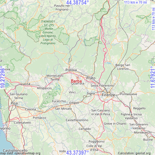
Barba GPS coordinates[2]
43° 52' 58.476" North, 10° 58' 33.888" East
| Map corner | latitude | longitude |
|---|---|---|
| Upper-left | 44.38754°, | 10.27296° |
| Center: | 43.88291°, | 10.97608° |
| Lower-right: | 43.37397°, | 11.67921° |
| Map W x H: | 112.7×112.7 km | = 70×70mi |
| max Lat: | 47.04031° ⇑55.9% North |
| Barba: | 43.88291° |
| min Lat: | ⇓44.1% South 35.50142° |
| min Long | Barba | max Long |
| 6.69888° | 10.97608° | 18.48682° |
| W 42.4%⇐ | ⇒57.6% E |
Elevation
Elevation of Barba is 40 m = 131 ft, and this is 266.7 m = 875 ft below average elevation for this country.
| Max E: |
2085 m = 6841 ft | 82.5% |
| Avg. | 306.7 m = 1006 ft | |
| Barba | 40 m = 131 ft | |
Min E: |
-4 m = -13 ft | 17.5% |
See also: Italy elevation on elevation.city.
Geographical zone
Barba is located in North temperate zone (between Tropic of Cancer and the Arctic Circle). Distance of this Northern Tropic circle is 2273.4 km =1412.6 mi to South.| Distance of | km | miles | from Barba |
|---|---|---|---|
| North Pole | 5127.7 | 3186.2 | to North |
| Arctic Circle | 2521.9 | 1567 | to North |
| Tropic Cancer | 2273.4 | 1412.6 | to South |
| Equator | 4879.3 | 3031.9 | to South |


Nearby cities:
15 places around Barba: (largest is in red/bold)
• Agliana
3.2 km =2 mi,  47°
47°
• Cantagrillo-Casalguidi
5.2 km =3.2 mi,  253°
253°
• Caserana
3.7 km =2.3 mi,  125°
125°
• Casini
3.3 km =2.1 mi,  144°
144°
• Catena
5.5 km =3.4 mi, 144°
• Fornacelle
6.6 km =4.1 mi, 46°
• Montale
6.6 km =4.1 mi,  29°
29°
• Montemurlo
6.9 km =4.3 mi, 45°
• Pistoia
6.8 km =4.2 mi,  321°
321°
• Quarrata
3.8 km =2.4 mi,  176°
176°
• Santonuovo
3.3 km =2.1 mi,  232°
232°
• Seano
6.9 km =4.3 mi,  148°
148°
• Stazione
4.7 km =2.9 mi,  40°
40°
• Valenzatico
2 km =1.2 mi,  206°
206°
• Vignole-Olmi
2.1 km =1.3 mi, 146°
Sources, notices
• [Note1] Compared only with cities in Italy existing in our database
• [Src1] Map data: © OpenStreetMap contributors (CC-BY-SA)
• [Src2] Other city data from geonames.org with taken over terms of usage.
• [Src3] Geographical zone / Annual Mean Temperature by Robert A. Rohde @ Wikipedia
