Ponte A Bozzone geodata
Ponte A Bozzone (Tuscany) is a populated locality; located in Italy in Europe/Rome (GMT+2) time zone. With population of 851 people, there are 7402 cities with bigger population in this country. Compared to other cities in Italy, 60.8% of cities are located further ↑North; 52.2% of cities are located further →East and 50.9% of cities have lower elevation than Ponte A Bozzone. Note1
Administrative division(s):
- Level 1: Tuscany
- Level 2: Provincia di Siena
- Level 3: Castelnuovo Berardenga


Ponte A Bozzone GPS coordinates[2]
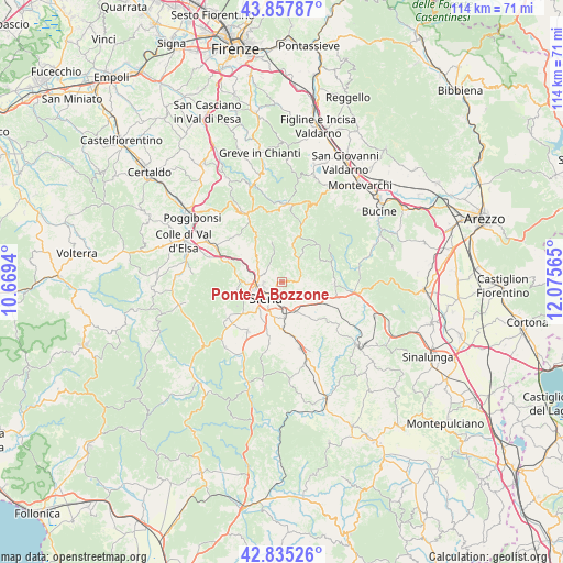
43° 20' 55.392" North, 11° 22' 21.072" East
| Map corner | latitude | longitude |
|---|---|---|
| Upper-left | 43.85787°, | 10.6694° |
| Center: | 43.34872°, | 11.37252° |
| Lower-right: | 42.83526°, | 12.07565° |
| Map W x H: | 113.7×113.7 km | = 70.6×70.6mi |
| max Lat: | 47.04031° ⇑60.8% North |
| Ponte A Bozzone: | 43.34872° |
| min Lat: | ⇓39.2% South 35.50142° |
| min Long | Ponte A Bozzone | max Long |
| 6.69888° | 11.37252° | 18.48682° |
| W 47.8%⇐ | ⇒52.2% E |
Elevation
Elevation of Ponte A Bozzone is 240 m = 787 ft, and this is 66.7 m = 219 ft below average elevation for this country.
| Max E: |
2085 m = 6841 ft | 49.1% |
| Avg. | 306.7 m = 1006 ft | |
| Ponte A Bozzone | 240 m = 787 ft | |
Min E: |
-4 m = -13 ft | 50.9% |
See also: Italy elevation on elevation.city.
Geographical zone
Ponte A Bozzone is located in North temperate zone (between Tropic of Cancer and the Arctic Circle). Distance of this Northern Tropic circle is 2214 km =1375.7 mi to South.| Distance of | km | miles | from Ponte A Bozzone |
|---|---|---|---|
| North Pole | 5187.1 | 3223.1 | to North |
| Arctic Circle | 2581.2 | 1603.9 | to North |
| Tropic Cancer | 2214 | 1375.7 | to South |
| Equator | 4819.9 | 2994.9 | to South |


Nearby cities:
15 places around Ponte A Bozzone: (largest is in red/bold)
• Arbia
6.8 km =4.2 mi,  153°
153°
• Badesse
8.9 km =5.5 mi,  295°
295°
• Belverde
5.2 km =3.2 mi,  269°
269°
• Castelnuovo Berardenga
10.3 km =6.4 mi,  91°
91°
• Gaiole in Chianti
14.1 km =8.8 mi,  20°
20°
• Isola D'Arbia
10 km =6.2 mi,  177°
177°
• Monteaperti
5.3 km =3.3 mi,  116°
116°
• Monteriggioni
12.9 km =8 mi,  290°
290°
• Monteroni d'Arbia
13.8 km =8.6 mi,  163°
163°
• Pianella
3.6 km =2.2 mi,  81°
81°
• Ponte A Tressa
11 km =6.8 mi,  170°
170°
• Sant'Andrea A Montecchio
9.3 km =5.8 mi,  218°
218°
• Siena
4.8 km =3 mi, 224°
• Sovicille
13.9 km =8.6 mi,  236°
236°
• Taverne D'Arbia
6.3 km =3.9 mi, 163°
Sources, notices
• [Note1] Compared only with cities in Italy existing in our database
• [Src1] Map data: © OpenStreetMap contributors (CC-BY-SA)
• [Src2] Other city data from geonames.org with taken over terms of usage.
• [Src3] Geographical zone / Annual Mean Temperature by Robert A. Rohde @ Wikipedia
