Monteaperti geodata
Monteaperti (Tuscany) is a populated place; located in Italy in Europe/Rome (GMT+2) time zone. With population of 652 people, there are 8620 cities with bigger population in this country. Compared to other cities in Italy, 60.9% of cities are located further ↑North; 51.5% of cities are located further →East and 52.8% of cities have lower elevation than Monteaperti. Note1
Administrative division(s):
- Level 1: Tuscany
- Level 2: Provincia di Siena
- Level 3: Castelnuovo Berardenga


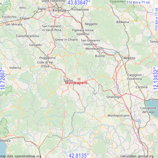
Monteaperti GPS coordinates[2]
43° 19' 37.704" North, 11° 25' 52.284" East
| Map corner | latitude | longitude |
|---|---|---|
| Upper-left | 43.83647°, | 10.72807° |
| Center: | 43.32714°, | 11.43119° |
| Lower-right: | 42.8135°, | 12.13432° |
| Map W x H: | 113.7×113.7 km | = 70.6×70.6mi |
| max Lat: | 47.04031° ⇑60.9% North |
| Monteaperti: | 43.32714° |
| min Lat: | ⇓39.1% South 35.50142° |
| min Long | Monteaperti | max Long |
| 6.69888° | 11.43119° | 18.48682° |
| W 48.5%⇐ | ⇒51.5% E |
Elevation
Elevation of Monteaperti is 252 m = 827 ft, and this is 54.7 m = 179 ft below average elevation for this country.
| Max E: |
2085 m = 6841 ft | 47.2% |
| Avg. | 306.7 m = 1006 ft | |
| Monteaperti | 252 m = 827 ft | |
Min E: |
-4 m = -13 ft | 52.8% |
See also: Italy elevation on elevation.city.
Geographical zone
Monteaperti is located in North temperate zone (between Tropic of Cancer and the Arctic Circle). Distance of this Northern Tropic circle is 2211.6 km =1374.2 mi to South.| Distance of | km | miles | from Monteaperti |
|---|---|---|---|
| North Pole | 5189.5 | 3224.6 | to North |
| Arctic Circle | 2583.6 | 1605.4 | to North |
| Tropic Cancer | 2211.6 | 1374.2 | to South |
| Equator | 4817.5 | 2993.5 | to South |


Nearby cities:
15 places around Monteaperti: (largest is in red/bold)
• Arbia
4.1 km =2.5 mi,  204°
204°
• Asciano
15.2 km =9.4 mi,  133°
133°
• Badesse
14.3 km =8.9 mi,  295°
295°
• Belverde
10.3 km =6.4 mi,  283°
283°
• Castelnuovo Berardenga
6 km =3.7 mi,  69°
69°
• Gaiole in Chianti
15.5 km =9.6 mi,  0°
0°
• Isola D'Arbia
8.7 km =5.4 mi,  209°
209°
• Monteroni d'Arbia
10.9 km =6.8 mi,  183°
183°
• Pianella
3.2 km =2 mi,  337°
337°
• Ponte A Bozzone
5.3 km =3.3 mi, 296°
• Ponte A Tressa
8.9 km =5.5 mi, 199°
• Rapolano Terme
14.3 km =8.9 mi,  104°
104°
• Sant'Andrea A Montecchio
11.7 km =7.3 mi,  245°
245°
• Siena
8.2 km =5.1 mi,  263°
263°
• Taverne D'Arbia
4.6 km =2.9 mi,  219°
219°
Sources, notices
• [Note1] Compared only with cities in Italy existing in our database
• [Src1] Map data: © OpenStreetMap contributors (CC-BY-SA)
• [Src2] Other city data from geonames.org with taken over terms of usage.
• [Src3] Geographical zone / Annual Mean Temperature by Robert A. Rohde @ Wikipedia
